2023 Bush Log
Bush Personal:
| Pineapple Point Round Trip. 8th of July 2023. Pineapple Point Clearance |
 |
| OTMC Orokonui Creek and Fence Track. 1st of July 2023. Orokonui Creek Track DOC Sign |
 |
| OTMC Orokonui Creek and Fence Track. 1st of July 2023. Hiking along the Gravel trail around the Orokonui Ecosanctuary Fence |
 |
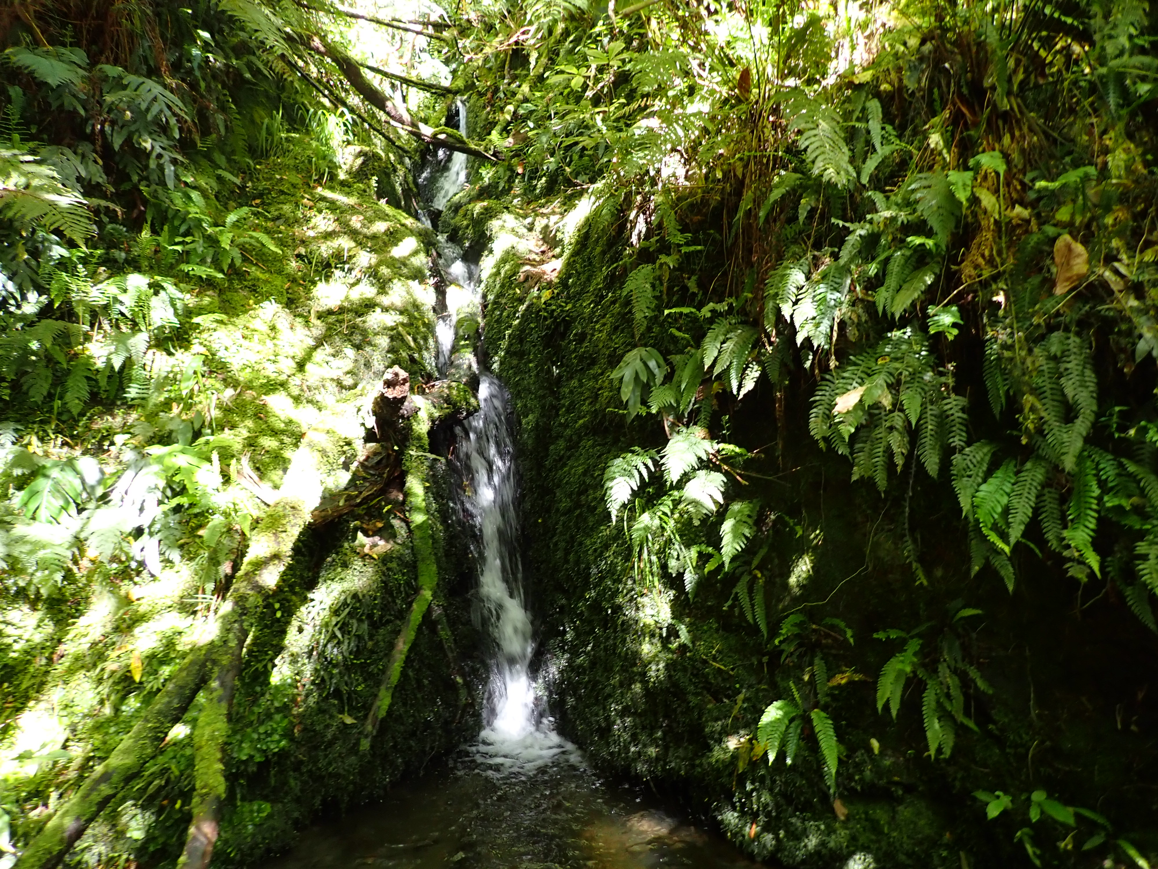
| OTMC Orokonui Creek and Fence Track. 1st of July 2023. Mopanui Stone Wall |
 |
| OTMC Orokonui Creek and Fence Track. 1st of July 2023. Descending back to the Orokonui Creek Track |
 |
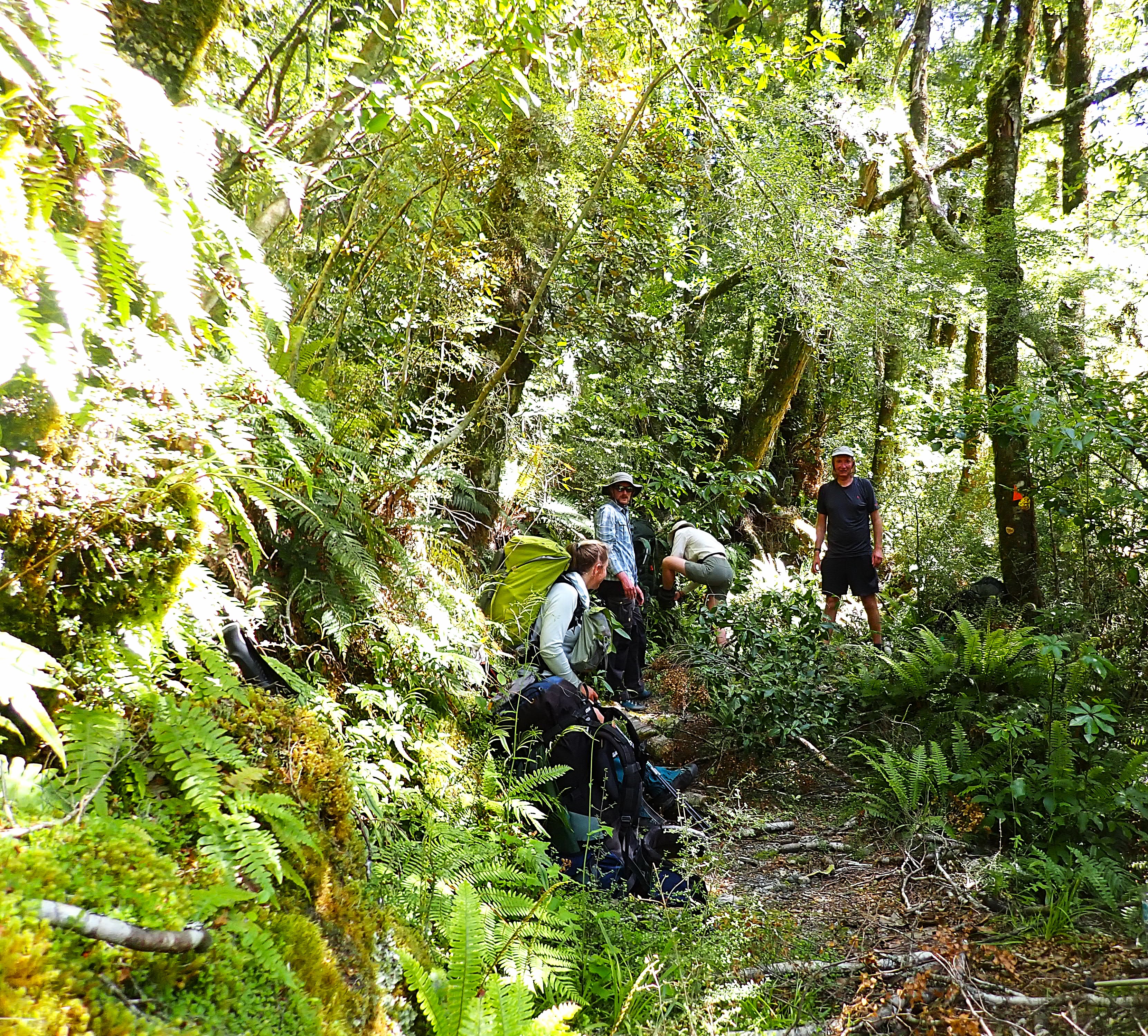
| TMC Orokonui Creek and Fence Track. 1st of July 2023. Steffan |
 |
| OTMC Hermits Cave Silverpeaks Trip. 21st of May 2023. Hiking along the Silverpeaks Track on Green Ridge. |
 |
| OTMC Hermits Cave Silverpeaks Trip. 21st of May 2023. The Silverpeaks Track along the tops from Pulpit Rock. |
 |
| OTMC Hermits Cave Silverpeaks Trip. 21st of May 2023. Debbie Guthrie and Antony Pettinger on Rocky Ridge. |
 |
| OTMC Hermits Cave Silverpeaks Trip. 21st of May 2023. Looking into Hermits Cave. |
.JPG) |
| OTMC Hermits Cave Silverpeaks Trip. 21st of May 2023. Coral Lichen (Cladia retipora). |
 |
| OTMC Hermits Cave Silverpeaks Trip. 21st of May 2023. Trig Station on Silver Peak. |
 |
| OTMC Hermits Cave Silverpeaks Trip. 21st of May 2023. The Silverpeaks Track. |
 |
| OTMC Macetown via Big Hill Trip. 29th of April 2023. Starting the Hike up to Eichardts Flat |
 |
| OTMC Macetown via Big Hill Trip. 29th of April 2023. The Remarkables and Lake Hayes from Eichardts Flat |
 |
| OTMC Macetown via Big Hill Trip. 29th of April 2023. Starting out on the Big Hill Walkway Track |
%20perched%20on%20top%20of%20the%20bluff.JPG) |
| OTMC Macetown via Big Hill Trip. 29th of April 2023. Karearea (NZ Falcon) perched on top of the bluff |
 |
| OTMC Macetown via Big Hill Trip. 29th of April 2023. The Brow Peak Ridgeline |
 |
| OTMC Macetown via Big Hill Trip. 29th of April 2023. The Gully heading down from the Big Hill Saddle |
 |
| OTMC Macetown via Big Hill Track. 29th of April 2023. Eight Mile Hut on the Coronet Loop Track |
 |
| OTMC Macetown via Big Hill Track. 29th of April 2023. Looking down the Arrow River |
 |
| OTMC Macetown via Big Hill Track. 29th of April 2023. The Macetown Bakehouse |
 |
| OTMC Macetown via Big Hill Track. 30th of April 2023. Departing from Needhams Cottage |
 |
| OTMC Macetown via Big Hill Track. 30th of April 2023. Crossing a Ford in the Arrow River |
 |
| OTMC Macetown via Big Hill Track. 30th of April 2023. The Macetown 4WD Track leading away from Soho Creek |
 |
| OTMC Macetown via Big Hill Track. 30th of April 2023. The Arrow River Pipeline Weir |
 |
| OTMC Macetown via Big Hill Track. 30th of April 2023. Coopers Terrace Info Panel |
 |
| OTMC Wild Dunedin Town Belt Trip. 22nd of April 2023. Antony presenting at the Southern Cemetery. |
 |
| OTMC Wild Dunedin Town Belt Trip. 22nd of April 2023. Mountain Rose at Robin Hood Park Lookout. |
 |
| OTMC Wild Dunedin Town Belt Trip. 22nd of April 2023. Olveston House. |
 |
| Rabbit Pass Easter Trip - 7th of April 2023. Flying into the landing strip in the Wilkin Valley. |
 |
| Rabbit Pass Easter Trip - 7th of April 2023. Hiking up toward Top Forks Hut. |
 |
| Rabbit Pass Easter Trip - 7th of April 2023. Top Forks Huts in the Upper Wilkin Valley. |
 |
| Rabbit Pass Easter Trip - 7th of April 2023. Looking down on the start of Waterfall Flat. |
 |
| Rabbit Pass Easter Trip - 7th of April 2023. Crossing Waterfall Flat. |
 |
| Rabbit Pass Easter Trip - 7th of April 2023. Christian traversing the Track on Waterfall Face. |
 |
| Rabbit Pass Easter Trip - 7th of April 2023. Campsite between Waterfall Face and Rabbit Pass in the Upper South Branch Wilkin River. |
 |
| Rabbit Pass Easter Trip - 7th of April 2023. Christian at our Campsite. |
 |
| Rabbit Pass Easter Trip - 8th of April 2023. Rabbit Pass. |
 |
| Rabbit Pass Easter Trip - 8th of April 2023. Christian descending the Rabbit Pass Descent Route. |
 |
| Rabbit Pass Easter Trip - 8th of April 2023. Head Waters of the Matukituki East Branch. |
 |
| Rabbit Pass Easter Trip - 8th of April 2023. Ruth Flat below Fastness Peak. |
 |
| Rabbit Pass Easter Trip - 9th of April 2023. Breakfast on Ruth Flat. |
 |
| Rabbit Pass Easter Trip - 9th of April 2023. Rainbow on the other side of Bledisloe Gorge. |
 |
| Rabbit Pass Easter Trip - 9th of April 2023. Looking down on Cameron Flat from the highpoint on the Bledisloe Gorge Track. |
 |
| Rabbit Pass Easter Trip - 9th of April 2023. John S Holloway No.2 Three Wire Bridge over the Matukituki East Branch. |
 |
| Rabbit Pass Easter Trip - 9th of April 2023. Approaching the West Matukituki Crossing at Camerons Flat. |
 |
| OTMC NEV to Signal Hill via Cleghorn Street 2nd of April 2023. Hiking up North Road. |
 |
| OTMC NEV to Signal Hill via Cleghorn Street 2nd of April 2023. Maree, Debbie, and Lucy hiking through the Rain. |
 |
| OTMC NEV to Signal Hill via Cleghorn Street 2nd of April 2023. Hiking alongside the Fenceline in the rain. |
 |
| OTMC NEV to Signal Hill via Cleghorn Street 2nd of April 2023. Ash having an early lunch at the Signal Hill Lookout. |
 |
| OTMC NEV to Signal Hill via Cleghorn Street 2nd of April 2023. Amanita muscaria. |
 |
| OTMC NEV to Signal Hill via Cleghorn Street 2nd of April 2023. Finishing at the Botanical Gardens Entrance in the Rain. |
 |
| OTMC Heyward Point Trip. 26th of March 2023. Climbing the Heyward Point Track. |
 |
| OTMC Heyward Point Trip 26th of March 2023 Looking back across the Heyward Point Track from where we've come. |
 |
| OTMC Heyward Point Trip 26th of March 2023. Heyward Point Scenic Reserve DOC Sign. |
 |
| OTMC Heyward Point Trip 26th of March 2023. Red Admiral Butterfly on a Coprosma Bush. |
 |
| OTMC Heyward Point Trip 26th of March 2023. Richard photographing the Wildlife from the Cliff Top. |
 |
| OTMC Heyward Point Trip 26th of March 2023. Lunchtime on Heyward Point. |
 |
| OTMC Heyward Point Trip 26th of March 2023. Hiking along the Heyward Point Track. |
 |
| OTMC Heyward Point Trip 26th of March 2023. Descending toward Aramoana from Heyward Point Road. |
 |
| OTMC Heyward Point Trip 26th of March 2023. Looking down at the Harbour. |
 |
| OTMC Saddle Hill Trip. 11th of March 2023. Gathering up in the top paddock on the side of Saddle Hill. |
 |
| OTMC Saddle Hill Trip. 11th of March 2023. Looking down the Coast from Saddle Hill. |
 |
| OTMC Saddle Hill Trip. 11th of March 2023. Morning Tea on Saddle Hill. |
 |
| OTMC Saddle Hill Trip. 11th of March 2023. Mosgiel View from Saddle Hill. |
 |
| OTMC Silver Peaks Half Marathon. 11th of February 2023. Climbing the Powder Ridge Track. |
 |
| OTMC Silver Peaks Half Marathon. 11th of February 2023. Soaking in the morning light on Flagstaff. |
 |
| OTMC Silver Peaks Half Marathon. 11th of February 2023. Concrete Weir on the Silver Stream. |
 |
| OTMC Silver Peaks Half Marathon. 11th of February 2023. Reaching the Silver Peaks Track after climbing up Long Ridge. |
 |
| OTMC Silver Peaks Half Marathon. 11th of February 2023. Blueskin Bay from the Swampy Summit Track. |
 |
| OTMC Silver Peaks Half Marathon. 11th of February 2023. Tim and Caitlin on the Swampy Summit Track. |
 |
| OTMC Silver Peaks Half Marathon. 11th of February 2023. Hiking along the Swampy Ridge Track. |
 |
| OTMC Silver Peaks Half Marathon. 11th of February 2023. Descending the Pineapple Track. |
 |
| Waikouaiti River Track Silver Peaks. 29th of January 2023 Descending the Miners Direct Track. |
 |
| Waikouaiti River Track Silver Peaks. 29th of January 2023. Jade hiking along the River Track. |
 |
| Waikouaiti River Track Silver Peaks. 29th of January 2023. Checking out the Walker Road Access from the River Track. |
 |
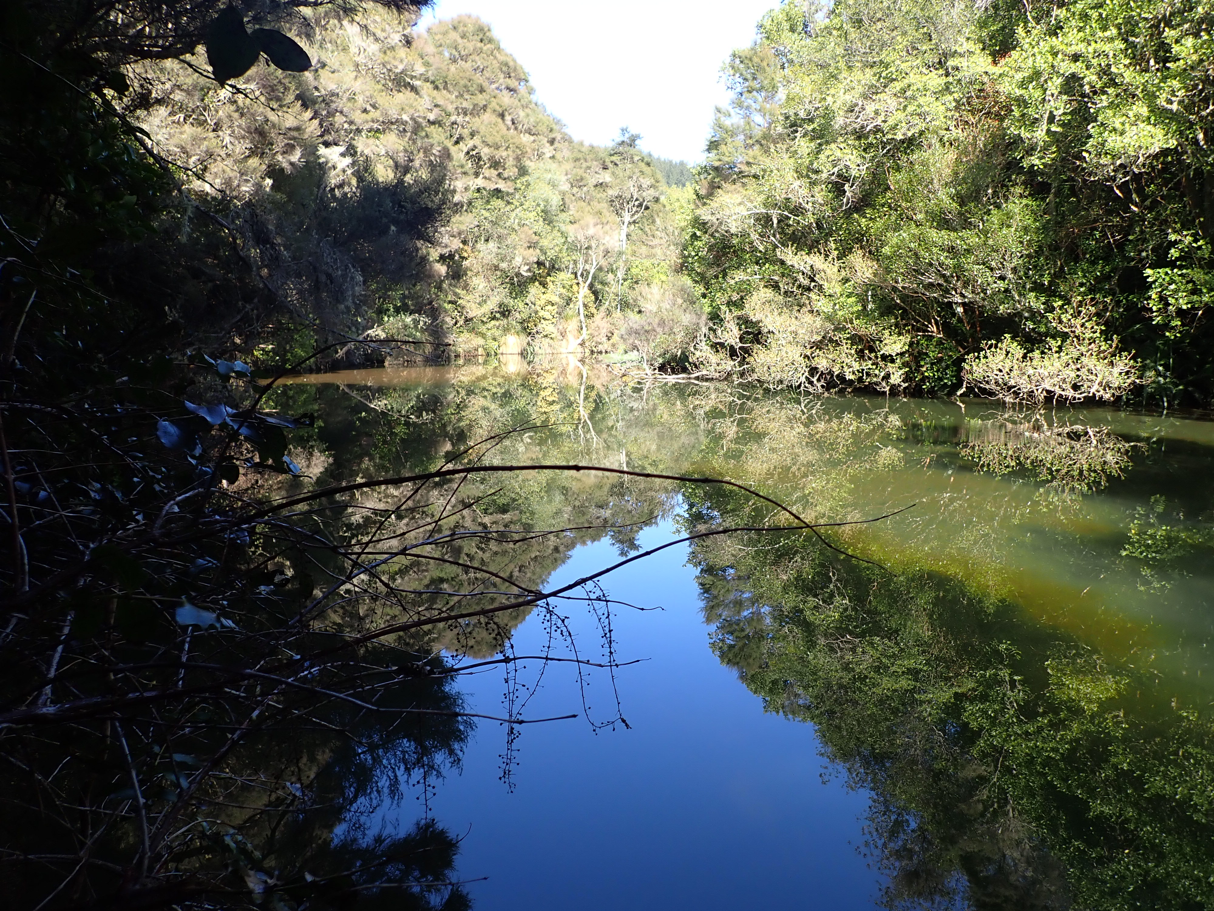
| Waikouaiti River Track Silver Peaks. 29th of January 2023. Pools in the Creek. |
 |
| Waikouaiti River Track Silver Peaks. 29th of January 2023. Hiking through the Bush Track to Yellow Ridge. |
 |
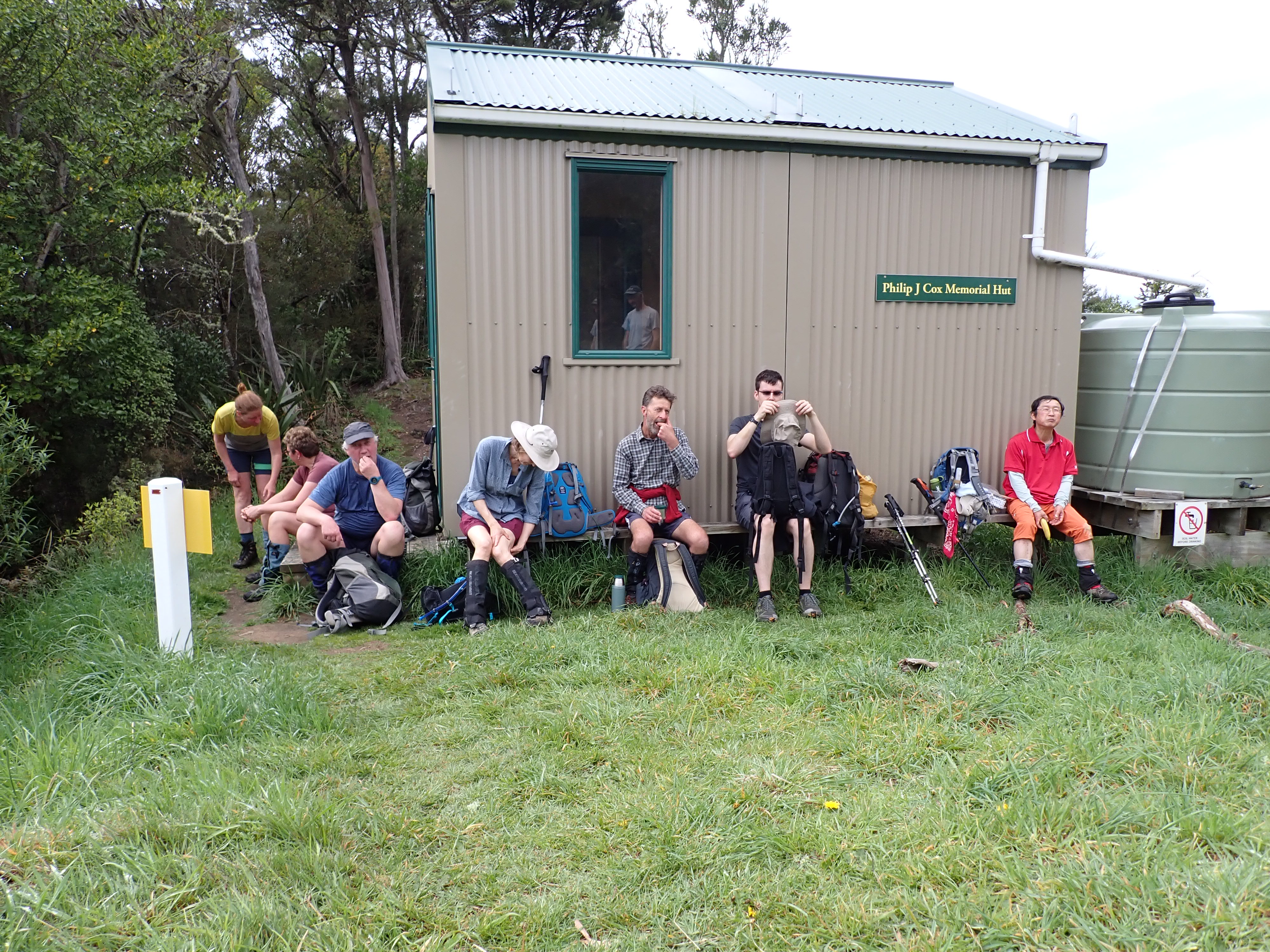
| Waikouaiti River Track Silver Peaks. 29th of January 2023. Philip J Cox Memorial Hut. |
 |
| Waikouaiti River Track Silver Peaks. 29th of January 2023. Clare on the Yellow Ridge Track. |
 |
| Waikouaiti River Track Silver Peaks. 29th of January 2023. Richard and David by the Rope. |
 |
| Waikouaiti River Track Silver Peaks. 29th of January 2023. Gathered up at the Silverpeaks Scenic Reserve DOC Sign. |
Bush Instruction:
 |
| Silverpeaks ABC Cave. 3rd of June 2023. Sharon looking out over the Coast from the top of Yellow Ridge |
 | |
| Silverpeaks ABC Cave. 3rd of June 2023. Sharon at the Tunnels on the Tunnels Track
|


 | ||
| Silverpeaks ABC Cave. 3rd of June 2023. The Silverpeaks Gap
|

 |
| Silverpeaks ABC Cave. 3rd of June 2023. Sleeping Bags laid out on the Sleeping Platform in ABC Cave |
 |
| Silverpeaks ABC Cave. 4th of June 2023. Sharon at the Waikouaiti River |
25/05/2023.
Otago Tramping and Mountaineering Club.
Steffan Rolfe, Antony Pettinger, Debbie Pettinger, and ~38 OTMC Club members.
Fine.
OTMC Club Rooms, St. Kilda, Dunedin.
OTMC Club Night Hollyford Guiding Presentation. (2 hours).
Bush Training (NZOIA):
 |
| Nelson Trip - NZOIA Bush Leader Revalidation. 6th of May 2023. Mark discussing different types of Maps |
2022 Bush Log
Bush Personal:
I went of a multi-day New Years trip with the Otago Tramping and Mountaineering Club in the Top Forks area of the Upper Wilkin River in Mt Aspiring National Park.
Day 1 – we drove from Dunedin to Makaroroa, and caught the Wilkin River Jet to Kerin Forks. From there we hiked up the Upper Wilkin River to the Jumboland Flats area, where we camped for the night. It was the first of the 30+ degree days we had in this area.
Day 2 – We carried on hiking up the Upper Wilkin to Top Forks hut. I camped outside as both Huts were quite full. It rained overnight, but this was the only rain we experienced during the trip.
Day 3 – We explored up the North Branch of Wilkin River, up to Lake Castalia, and then Lucidus Lake on the way back. I gave some river crossing instruction to the team on the way up.
Day 4 – We hiked up to Waterfall Flat from Top Forks. We camped at Waterfall Flat for New Years Eve.
Day 5 – I spent the day exploring Waterfall Flat. I initially headed part-way up Waterfall Face, but came down at the top of the Tussock Fan. I then headed to the two waterfalls, and then down to the Bivvy Rock.
Day 6 – We headed back down to Top Forks Hut, where we spent another night.
Day 7 – We headed down the Upper Wilkin River back to Kerin Forks Hut, where we spent the night in the Hut.
Day 8 – We explored around Kerin Forks Flat, and then caught the Wilkin River Jet back down the Wilkin River to Makarora. We drove back to Dunedin from there.
 |
| OTMC Upper Wilkin Xmas Trip. 28th of December 2022. Jetboating down the river on the Wilkin River Jet. |
 |
| OTMC Upper Wilkin Xmas Trip. 28th of December 2022. Looking down the Wilkin River toward Kerin Forks. |
 |
| OTMC Upper Wilkin Xmas Trip. 28th of December 2022. Rest stop on the Wilkin River Track. |
 |
| OTMC Upper Wilkin Xmas Trip. 28th of December 2022. Setting up Camp at Jumboland. |
 |
| OTMC Upper Wilkin Xmas Trip. 29th of December 2022. The Wilkin River at Jumboland. |
 |
| OTMC Upper Wilkin Xmas Trip. 29th of December 2022. Crossing a side stream with a little cascade below it. |
 |
| OTMC Upper Wilkin Xmas Trip. 29th of December 2022. Picking our way up through the tall grasses on the River Flats. |
 |
| OTMC Upper Wilkin Xmas Trip. 29th of December 2022. The slopes of Mt Betsy Jane from the Wilkin River Valley. |
 |
| OTMC Upper Wilkin Xmas Trip. 29th of December 2022. Top Forks Hut. |
 |
| OTMC Upper Wilkin Xmas Trip. 30th of December 2022. Reflections in the Waters of Disappearing Tarn. |
 |
| OTMC Upper Wilkin Xmas Trip. 30th of December 2022. Lake Diana. |
 |
| OTMC Upper Wilkin Xmas Trip. 30th of December 2022. River Crossing in the Wilkin River North Branch. |
 |
| OTMC Upper Wilkin Xmas Trip. 30th of December 2022. The River crossing in the Upper Wilkin North Branch. |
.JPG) |
| OTMC Upper Wilkin Xmas Trip. 30th of December 2022. Mt Cook Lillies (Ranunculus lyallii). |
 |
| OTMC Upper Wilkin Xmas Trip. 30th of December 2022. Approaching the Lake Castalia Basin. |
 |
| OTMC Upper Wilkin Xmas Trip. 30th of December 2022. Lake Castalia Basin. |
 |
| OTMC Upper Wilkin Xmas Trip. 30th of December 2022. Looking down the Wilkin River North Branch from the Head of the Valley. |
 |
| OTMC Upper Wilkin Xmas Trip. 30th of December 2022. Sharon on the Wilkin River North Branch Track. |
 |
| OTMC Upper Wilkin Xmas Trip. 30th of December 2022. Lucidus Lake. |
 |
| OTMC Upper Wilkin Xmas Trip. 30th of December 2022. Reflections in the Waters of Disappearing Tarn. |
 |
| OTMC Upper Wilkin Xmas Trip. 30th of December 2022. Mt Castor and Mt Pollux as the Sun goes down. |
.JPG) |
| OTMC Upper Wilkin Xmas Trip. 31st of December 2022. Tutukiwi Green Hooded Orchid (Pterostylis banksii). |
 |
| OTMC Upper Wilkin Xmas Trip. 31st of December 2022. Tomas and the Crew taking a break on the way to Waterfall Flat. |
 |
| OTMC Upper Wilkin Xmas Trip. 31st of December 2022. Steffan approaching Waterfall Flat. |
 |
| OTMC Upper Wilkin Xmas Trip. 31st of December 2022. First Sight of Waterfall Face with Mt Taurus above. |
 |
| OTMC Upper Wilkin Xmas Trip. 31st of December 2022. New Years Eve at the Waterfall Face Campsite. |
 |
| OTMC Upper Wilkin Xmas Trip. 1st of January 2023. Waterfall Flat and Mt Twilight. |
 |
| OTMC Upper Wilkin Xmas Trip. 1st of January 2023. Looking out of the Snow Cave. |
 |
| OTMC Upper Wilkin Xmas Trip. 1st of January 2023. Cascade pouring down the Rockface. |
 |
| OTMC Upper Wilkin Xmas Trip. 1st of January 2023. Two Tiers of the Waterfall visible. |
 |
| OTMC Upper Wilkin Xmas Trip. 1st of January 2023. Waterfall Face from the Slopes above Waterfall Flat. |
 |
| OTMC Upper Wilkin Xmas Trip. 1st of January 2023. Looking out of the Snow Cave down to Waterfall Flat. |
 |
| OTMC Upper Wilkin Xmas Trip. 1st of January 2023. Waterfall Flat Bivvy Rock. |
 |
| OTMC Upper Wilkin Xmas Trip. 1st of January 2023. Our Campsite at Waterfall Flat. |
 |
| OTMC Upper Wilkin Xmas Trip. 2nd of January 2023. The end of Waterfall Flat dropping into the Valley. |
.JPG) |
| OTMC Upper Wilkin Xmas Trip. 2nd of January 2023. Mt Castor and Mt Pollux (The Twins). |
 |
| OTMC Upper Wilkin Xmas Trip. 2nd of January 2023. The Boys soaking in the Mountain Air at Top Forks. |
 |
| OTMC Upper Wilkin Xmas Trip. 3rd of January 2023. Rays of Light over the Upper Wilkin River. |
 |
| OTMC Upper Wilkin Xmas Trip. 3rd of January 2023. Heading down the Wilkin Valley Track beside the Wilkin River. |
 |
| OTMC Upper Wilkin Xmas Trip. 3rd of January 2023. Tomas beside the Woody Bracket Fungus. |
 |
| OTMC Upper Wilkin Xmas Trip. 3rd of January 2023. Rodger and Saskia in the Kerin Forks Kitchen. |
 |
| OTMC Upper Wilkin Xmas Trip. 4th of January 2023. Leaving Kerin Forks Hut. |
 |
| OTMC Upper Wilkin Xmas Trip. 4th of January 2023. Old Station Hut on Kerin Forks Flats. |
 |
| OTMC Upper Wilkin Xmas Trip. 4th of January 2023. Wilkin River Jetboat on the Wilkin River. |
 |
| OTMC Upper Wilkin Xmas Trip. 4th of January 2023. Jet Boat Driver delivering Interp at the Wilkin Makarora Confluence. |
 |
| OTMC Leishmans Falls and Chalkies Track. 10th of December 2022. Leishmans Falls. |
 |
| OTMC Leishmans Falls and Chalkies Track. 10th of December 2022. Richard, Helen, and Tracey on the Chalkies Track. |
 |
| OTMC Leishmans Falls and Chalkies Track. 10th of December 2022. The Group by the Powder Hill Trig. |
 |
| OTMC Leishmans Falls and Chalkies Track. 10th of December 2022. Richard checking out the Limestone Cliffs of the Chalkies. |
 |
| OTMC Leishmans Falls and Chalkies Track. 10th of December 2022. Mandie and Helen descending the Chalkies Track. |
 |
| OTMC Leishmans Falls and Chalkies Track. 10th of December 2022. Approaching the Ford on the Racemans Track Whare Flat. |
 |
| OTMC Three Ridges Trip. 30th of October 2022. Taking a break at Philip J Cox Memorial Hut. |
 |
| OTMC Three Ridges Trip. 30th of October 2022. The Yellow Ridge Track climbing up the Ridgeline. |
 |
| OTMC Three Ridges Trip. 30th of October 2022. Sidling around Point 656 on Rocky Ridge. |
 |
| OTMC Three Ridges Trip. 30th of October 2022. Looking along Rocky Ridge toward Silver Peak. |
 |
| OTMC Three Ridges Trip. 30th of October 2022. Debbie, Mark, and the Crew on the Rocky Ridge Track. |
 |
| OTMC Three Ridges Trip. 30th of October 2022. Looking down Cave Creek across the Silverpeaks from Rocky Ridge. |
 |
| OTMC Three Ridges Trip. 30th of October 2022. Silverpeaks Track leading to Pulpit Rock. |
 |
| OTMC Three Ridges Trip. 30th of October 2022. The OTMC Crew at the Track End. |
 |
| OTMC Black Gully and Careys Track. 23rd of October 2022. Looking over the Waters of Black Gully Dam. |
 | ||
| OTMC Black Gully and Careys Track. 23rd of October 2022. Zig Zag heading down to Careys Creek Track.
|

 |
| OTMC Black Gully and Careys Track. 23rd of October 2022. Crossing Careys Creek. |
 |
| OTMC Black Gully and Careys Track. 23rd of October 2022. OTMC Crew at the Rongomai Track Junction. |
 |
| OTMC Black Gully and Careys Track. 23rd of October 2022. Evansdale Glen. |
 |
| Queenstown Hill Te Tapunui Time Walk. 18th of September 2022. Plaque on the Te Tapunui Time Walk. |
 |
| Queenstown Hill Te Tapunui Time Walk. 18th of September 2022. Fairy House. |
 |
| Queenstown Hill Te Tapunui Time Walk. 18th of September 2022. The Remarkable View from the top of Queenstown Hill. |
 |
| Queenstown Hill Te Tapunui Time Walk. 18th of September 2022. Lake Wakatipu View from the Basket of Dreams. |
 |
| Queenstown Hill Te Tapunui Time Walk. 18th of September 2022. The Basket of Dreams in front of Ben Lomond and Bowen Peak. |
 |
| Queenstown Hill Te Tapunui Time Walk. 18th of September 2022. Looking across to Cecil Peak and Walter Peak. |
 |
| OTMC Puketapu Palmerston Trip. 10th of September 2022. The Track heading between the two Eucalypts. |
 |
| OTMC Puketapu Palmerston Trip. 10th of September 2022. Steffan. |
 |
| OTMC Puketapu Palmerston Trip. 10th of September 2022. Sir John McKenzie Monument on Puketapu. |
 |
| OTMC Puketapu Palmerston Trip. 10th of September 2022. Looking down on the crew hiking up the end of the track. |
 |
| OTMC Puketapu Palmerston Trip. 10th of September 2022. The OTMC Crew at the Sir John McKenzie Memorial on Puketapu. |
 |
| OTMC Puketapu Palmerston Trip. 10th of September 2022. Sidling around the side of Puketapu. |
 |
| OTMC Puketapu Palmerston Trip. 10th of September 2022. Cheeky Gnomes. |
 |
| Mud Sweat and Tears Dunedin 2022. 17th of July 2022. Steffan arriving at the Finish Line. |
 |
| OTMC Boulder Beach - 26th of June 2022. Looking down at the Otago Harbour from the Greenacres Track. |
 |
| OTMC Boulder Beach - 26th of June 2022. NZs first Cheese Factory Sign. |
 |
| OTMC Boulder Beach - 26th of June 2022. Following Buskin Track down toward Boulder Beach. |
 |
| OTMC Boulder Beach - 26th of June 2022. Arriving at the Breakers at Boulder Beach. |
 |
| OTMC Boulder Beach - 26th of June 2022. Boulder Beach and Highcliff. |
 |
| OTMC Boulder Beach - 26th of June 2022. Windswept Tree near the Paradise Track. |
 |
| OTMC Boulder Beach - 26th of June 2022. Greenacres Track Descending beside the Windbreak. |
 |
| Drizzly Sunrise Flagstaff Walk. 19th of June 2022. A damp looking Flagstaff Walk. |
 |
| Drizzly Sunrise Flagstaff Walk. 19th of June 2022. Looking back up the Flagstaff Track. |
____________________________________
 |
| Abel Tasman Track - 16th of May 2022. Split Apple Rock. |
 |
| Abel Tasman - 16th of May 2022. Abel Tasman Water Taxi in Torrent Bay. |
 |
| Abel Tasman Track - 16th of May 2022. Water Taxi at Totaranui. |
 |
| Abel Tasman Track - 16th of May 2022. The Avenue at Totaranui. |
 |
| Abel Tasman Track - 16th of May 2022. Totaranui Beach. |
 |
| Abel Tasman Track. 16th of May 2022. Crossing Kaikau Stream on the Gibbs Hill Track. |
 |
| Abel Tasman Track. 16th of May 2022. Mamuka towering above the Gloom. |
.JPG) |
| Abel Tasman Track - 16th of May 2022 Stinking Ground Beetle (Plocamostethus planiusculus). |
 |
| Abel Tasman Track - 16th of May 2022. Wainui Inlet. |
 |
| Abel Tasman Track - 16th of May 2022 Abel Tasman Coastal Track Entrance at Wainui. |
 |
| Abel Tasman Track - 16th of May 2022. Well Carved Track leading to Whariwharangi. |
 |
| Abel Tasman Track - 16th of May 2022 Whariwharangi Hut. |
 |
| Abel Tasman Track - 17th of May 2022. Mist over the Separation Point Track. |
 |
| Abel Tasman Track - 17th of May 2022. Seperation Point Lighthouse. |
 |
| Abel Tasman Track - 17th of May 2022. Anatakapau Bay. |
 |
| Abel Tasman Track. 17th of May 2022. Pied Shag Drying its Wings on the Beach. |
 |
| Abel Tasman Track. 17th of May 2022. Abel Tasman Coastal Rain Forest. |
 |
| Abel Tasman Track - 17th of May 2022. Following the Road back to Totaranui. |
 |
| Abel Tasman Track. 17th of May 2022. Golden Sands at Goat Bay. |
 |
| Abel Tasman Track. 17th of May 2022. The Sandy Track heading down toward Awaroa Inlet. |
 |
| Abel Tasman Track. 17th of May 2022. Crossing Awaroa Inlet at Tow Tide. |
 |
| Abel Tasman Track - 17th of May 2022. Awaroa Hut. |
 |
| Abel Tasman Track - 18th of May 2022. High Tide outside Awaroa Hut. |
 | ||
|

 |
| Abel Tasman Track. 18th of May 2022. Richardson Stream Outlet at High Tide at Onetahuti. |
 |
| Abel Tasman Track - 18th of May 2022. Fernbird in the Flax. |
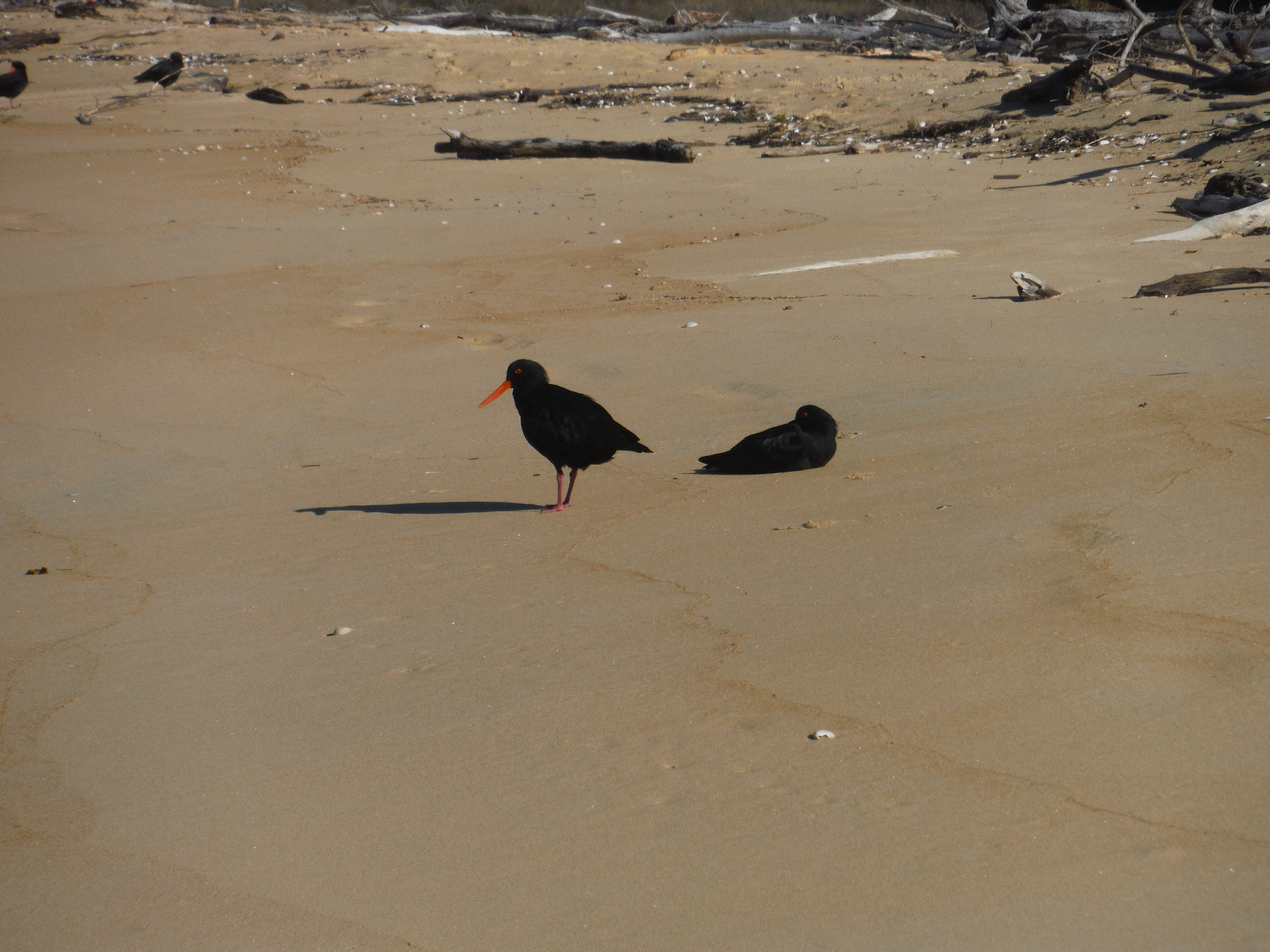 |
| Abel Tasman Track - 18th of May 2022. Variable Oyster Catchers. |
 |
| Abel Tasman Track - 18th of May 2022 Tonga Island from Onetahuti Bay Camp. |
 |
| Abel Tasman Track - 18th of May 2022 Tonga Quarry Picnic Area DOC Sign. |
 |
| Abel Tasman Track - 18th of May 2022. Track above Bark Bay. |
 |
| Abel Tasman Track - 18th of May 2022. Bark Bay Inlet near Waterfall Creek. |
 |
| Abel Tasman Track - 18th of May 2022 Huffam Stream flowing into Bark Bay. |
 |
| Abel Tasman Track - 18th of May 2022 Bark Bay Campsite. |
 |
| Abel Tasman Track - 19th of May 2022. Bark Bay Hut. |
 |
| Abel Tasman Track - 19th of May 2022 Hohaia Rangiauru. |
 |
| Abel Tasman Track - 19th of May 2022 Looking down on the Sandfly Bay Inlet. |
 |
| Abel Tasman Track - 19th of May 2022 Stream flowing below Halfway Pool. |
 |
| Abel Tasman Track - 19th of May 2022 Rainbow over Torrent Bay. |
 |
| Abel Tasman Track - 19th of May 2022 The Low Tide Crossing at Torrent Bay at High Tide. |
 |
| Abel Tasman Track - 19th of May 2022 Torrent River. |
 |
| Abel Tasman Track - 19th of May 2022. Anchorage Track Junction at my Lunch Stop on the way back to Marahau. |
 |
| Abel Tasman Track - 19th of May 2022. Footbridge over Observation Creek. |
 |
| Abel Tasman Track - 19th of May 2022. Black Back Gull taking off in front of Adele Island. |
 |
| Abel Tasman Track - 19th of May 2022. Apple Tree Bay Campsite. |
 |
| Abel Tasman Track - 19th of May 2022 Coquille Bay. |
 |
| Abel Tasman Track - 19th of May 2022. Looking over Sandy Bay to Marahau. |
 |
| Abel Tasman Track - 19th of May 2022. Carved Arch at the Marahau Startpoint of the Abel Tasman Coastal Track. |
 |
| Abel Tasman Track - 18th of May 2022. Awaroa Bay View from above. |
 |
| Chingford Park & Baldwin Street. 25th of April 2022. The Chingford Stables. |
 |
| Chingford Park & Baldwin Street. 25th of April 2022. Street Poem on Baldwin Street. |
 |
| Chingford Park & Baldwin Street. 25th of April 2022. Looking down Baldwin Street. |
 |
| OTMC Leith Saddle Rain Gauge Circuit. 10th of April 2022. OTMC Group at Rustler Burns Track Junction. |
 |
| OTMC Leith Saddle Rain Gauge Circuit. 10th of April 2022. Hiking along the Pipeline Track. |
 |
| OTMC Leith Saddle Rain Gauge Circuit. 10th of April 2022. Climbing the Coal Creek Spur. |
 |
| OTMC Leith Saddle Rain Gauge Circuit. 10th of April 2022. Descending the start of Raingauge Spur. |
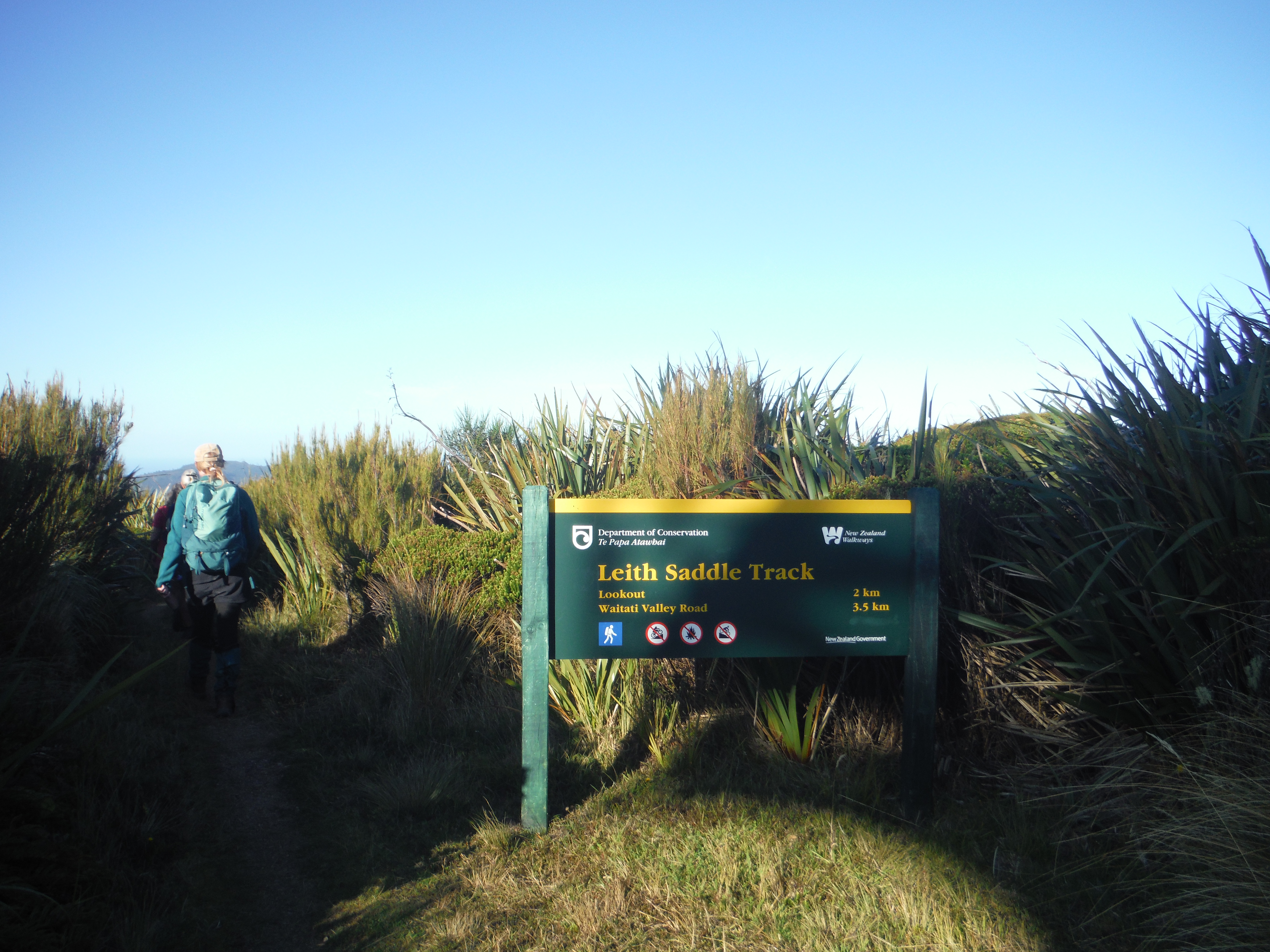 |
| OTMC Leith Saddle Rain Gauge Circuit. 10th of April 2022. Leith Saddle DOC Sign. |
 |
| OTMC Leith Saddle Rain Gauge Circuit. 10th of April 2022. OTMC Group walking up Rollinsons Road. |
 |
| OTMC Leith Saddle Rain Gauge Circuit. 10th of April 2022. Mountain Cedar above the Track. |
 |
| Mt Iron Track - Wanaka. 2nd of April 2022. Wanaka and the Mt Roy Skyline. |

 |
| Mt Iron Track - Wanaka. 2nd of April 2022. Bluffs on the side of Mt Iron. |
 |
| Mosgiel Rotary Club Saddlehill Hike. 27th of February 2022. Looking down on Brighton from Saddlehill. |
 |
| Mosgiel Rotary Club Saddlehill Hike. 27th of February 2022. Arriving at the Summit of Saddlehill. |
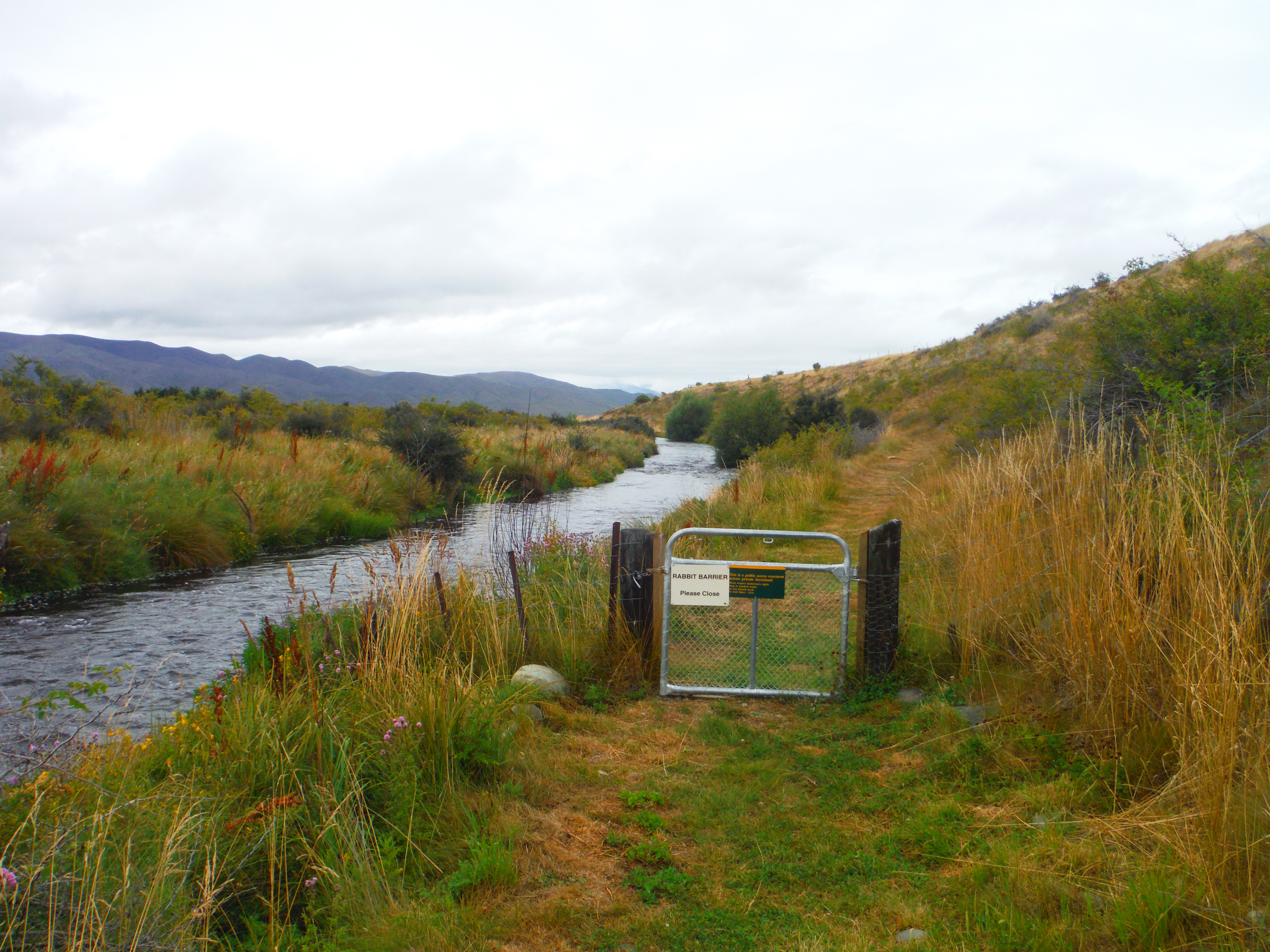 |
| Tekapo Mary Burn & Simons Hill Track. 5th of February 2022. Rabbit Barrier Gate beside the Mary Burn. |
 |
| Tekapo Mary Burn & Simons Hill Track. 5th of February 2022. Bend in the Fence Wire. |
 |
| Tekapo Mary Burn & Simons Hill Track. 5th of February 2022. Simons Hill Conservation Area. |
 |
| Tekapo Mary Burn & Simons Hill Track. 5th of February 2022. Hay Bales beneath Simons Hill. |
 |
| Frasers Gully to Flagstaff. 8th of January 2022. Frasers Gully Sign. |
 |
| Frasers Gully to Flagstaff. 8th of January 2022. Spiers Road Track Sign. |
 |
| Frasers Gully to Flagstaff. 8th of January 2022. Saddle Hill View from Flagstaff. |
 |
| Frasers Gully to Flagstaff. 8th of January 2022. Track through Native Bush in Frasers Gully. |
 |
| Frasers Gully to Flagstaff. 8th of January 2022. Frasers Stream. |
 |
| Silverpeaks Loop - 2nd of January 2022. The Old Green Hut Site. |
 |
| Silverpeaks Loop - 2nd of January 2022. Silverpeaks Track and Green Hill. |
 |
| Silverpeaks Loop - 2nd of January 2022. Kees descending the Devils Staircase. |
 |
| Silverpeaks Loop - 2nd of January 2022. Kees at the Cave Creek Camp Site. |
 |
| Silverpeaks Loop - 2nd of January 2022. Jubilee Hut. |
 |
| Silverpeaks Loop - 3rd of January 2022. Hiking along the Yellow Ridge Track. |
 |
| Silverpeaks Loop - 3rd of January 2022. Kees at ABC Cave. |
 |
| Silverpeaks Loop - 3rd of January 2022. Kees on the Yellow Ridge Track. |
 |
| Silverpeaks Loop - 3rd of January 2022. Ferns lining the Yellow Ridge Track. |
 |
| Silverpeaks Loop - 3rd of January 2022. Silverpeaks Scenic Reserve DOC Sign. |
Bush Instruction:
 |
| OTMC Macandrew Bay to Larnachs Castle. 26th of September 2022. Larnachs Castle amidst the Mist. |
 |
| OTMC Macandrew Bay to Larnachs Castle. 26th of September 2022. Looking down Greenacres Track toward the Harbour. |
 |
| OTMC Macandrew Bay to Larnachs Castle. 26th of September 2022. Larnachs Castle. |
 |
| OTMC Macandrew Bay to Larnachs Castle. 26th of September 2022. The Gardens and Totara Topiaries in Front of the Ballroom. |
 |
| OTMC Macandrew Bay to Larnachs Castle. 26th of September 2022. Kaka Beak Flower. |
 |
| OTMC Macandrew Bay to Larnachs Castle. 26th of September 2022. Pergola in the Green Room. |
 |
| OTMC Macandrew Bay to Larnachs Castle. 26th of September 2022. Looking through the Mist to the Harbour Island. |
 |
| OTMC Macandrew Bay to Larnachs Castle. 26th of September 2022. Back of Larnachs Castle. |
 |
| OTMC Macandrew Bay to Larnachs Castle. 26th of September 2022. Larnachs Castle. |
 |
| OTMC Macandrew Bay to Larnachs Castle. 26th of September 2022. Heading down Castlewood Road to Company Bay. |
 |
| OTMC Eucalypt Spur to Pulpit Rock. 2nd of July 2022. Steffan and Chris looking out the Possum Hut Window. |
 |
| OTMC Eucalypt Spur to Pulpit Rock. 2nd of July 2022. Chris and Fliss on Pulpit Rock. |
2021 Bush Log
Bush Personal:
 |
| Big Hut Rock & Pillar Range. 29th of December 2021. Rock and Pillar Conservation Area DOC Sign. |
 |
| Big Hut Rock & Pillar Range. 29th of December 2021. Marker Posts on the Spur. |
 |
| Big Hut Rock & Pillar Range. 29th of December 2021. Poled Route leading to Big Hut. |
 |
| Big Hut Rock & Pillar Range. 29th of December 2021. Big Hut on the Rock & Pillar Range. |
 |
| Big Hut Rock & Pillar Range. 30th of December 2021. Looking down on the Strath Taieri Plains from Big Hut. |
 |
| Big Hut Rock & Pillar Range. 30th of December 2021. Mosses and Lichens on the Rock & Pillar Range. |
 |
| Big Hut Rock & Pillar Range. 30th of December 2021. Cloud building over the Rock & Pillar Range. |
 |
| Inland Pack Track - 23rd of October 2021. Paparoa Track DOC Sign. |
 |
| Inland Pack Track - 23rd of October 2021. Entry Gateway on the Paparoa Trail. |
 |
| Inland Pack Track - 23rd of October 2021. Pororari River from the Footbridge. |
 |
| Inland Pack Track - 23rd of October 2021. Grike from the Footbridge. |
 |
| Inland Pack Track - 23rd of October 2021. Back in the Old Growth Forest. |
 |
| Inland Pack Track - 23rd of October 2021. Plantings at the Bullock Creek River Flats. |
 |
| Inland Pack Track - 23rd of October 2021. Stony Riverbed of Bullock Creek. |
 |
| Inland Pack Track - 23rd of October 2021. West Coast Forest on the Inland Pack Track. |
 |
| Inland Pack Track - 23rd of October 2021. Inland Pack Track Sign at Fossil Creek. |
 |
| Inland Pack Track - 23rd of October 2021. Can't go over, Can't go under. |
 |
| Inland Pack Track - 23rd of October 2021. Dilemma Creek and Fossil Creek Confluence. |
 |
| Inland Pack Track - 23rd of October 2021. Flowing Waters of Dilemma Creek |
 |
| Inland Pack Track - 23rd of October 2021. Ships Prow at the Confluence. |
 |
| Inland Pack Track - 24th of October 2021. Camping at the Ballroom Overhang. |
 |
| Inland Pack Track - 24th of October 2021. Fox River. |
 |
| Inland Pack Track - 24th of October 2021. Fox River Gorge. |
 |
| Inland Pack Track - 24th of October 2021. Inland Pack Track. |
 |
| Inland Pack Track - 24th of October 2021. The Weka Wall. |
 |
| Coal Creek Falls Walk - 2nd of October 2021. Coal Creek. |
 |
| Coal Creek Falls Walk - 2nd of October 2021. Coal Creek Falls. |
 |
| Coal Creek Falls Walk - 2nd of October 2021. Path through the Kamahi Forest. |
 |
| Casey Binser Circuit - 25th of September 2021. Hiking up the Steep Start to the Andrews Track. |
 |
| Casey Binser Circuit - 25th of September 2021. Flooded Side stream on the Andrews Track. |
 |
| Casey Binser Circuit - 25th of September 2021. Casey Hut. |
 |
| Casey Binser Circuit - 26th of September 2021. Poulter River Track. |
 |
| Casey Binser Circuit - 26th of September 2021. Crossing Mt Brown Creek on the Poulter River Track. |
 |
| Casey Binser Circuit - 26th of September 2021. Snow on Binser Saddle. |
 |
| Casey Binser Circuit - 26th of September 2021. Snow on the Craigeburn Cutting. |
 |
| Casey Binser Circuit - 26th of September 2021. View of the Waimakariri River. |
 |
| Hawdon Hut Arthurs Pass National Park. July-August 2021. ATV Track up the Hawdon River. |
 |
| Hawdon Hut Arthurs Pass National Park. July-August 2021. Kees and Fiona in the Hawdon Valley. |
 |
| Hawdon Hut Arthurs Pass National Park. July-August 2021. Hawdon River flowing down the Valley. |
 |
| Hawdon Hut Arthurs Pass National Park. July-August 2021. Hawdon Hut. |
 |
| Hawdon Hut Arthurs Pass National Park. July-August 2021. Kees and Fiona at our Lunch Spot beside the Hawdon River. |
 |
| Hawdon Hut Arthurs Pass National Park. July-August 2021. The Hawdon Valley. |
 |
| Hawdon Hut Arthurs Pass National Park. July-August 2021. Stream flowing out of the Mountains toward the Hawdon. |
- |
| Hawdon Hut Arthurs Pass National Park. July-August 2021. Narrow fast flowing Hawdon River. |
___________________________________
 |
| Arthurs Pass Otira Valley Track 24th of July 2021 Mt Philistine above the Otira Valley Track. |
 |
| Arthurs Pass Otira Valley Track - 24th of July 2021 Otira Valley Track over the Scree Slope. |
 |
| Arthurs Pass Otira Valley Track 24th of July 2021 Otira Valley Track over the Scree Slope. |
 |
| Arthurs Pass Otira Valley Track 24th of July 2021. The Otira River flowing through the Mountains. |
 |
| Arthurs Pass Otira Valley Track 24th of July 2021 Descending the Boardwalk down the Otira Valley Track. |
 |
| Arthurs Pass Walk & Dobson Nature Trail. 20th of June 2021. Avalanche Creek Cascades. |
 |
| Arthurs Pass Walk & Dobson Nature Trail. 20th of June 2021. Bridal Veil Creek. |
 |
| Arthurs Pass Walk & Dobson Nature Trail. 20th of June 2021. Arthurs Pass Walking Track DOC Sign. |
 |
| Arthurs Pass Walk & Dobson Nature Trail. 20th of June 2021. Cloud sweeping through Arthurs Pass. |
 |
| Arthurs Pass Walk & Dobson Nature Trail. 20th of June 2021. Tarn on the Pass. |
 |
| Arthurs Pass Walk & Dobson Nature Trail. 20th of June 2021. Lake Misery on Arthurs Pass. |
 |
| Arthurs Pass Walk & Dobson Nature Trail. 20th of June 2021. Dobson Memorial. |
 |
| Arthurs Pass Walk & Dobson Nature Trail. 20th of June 2021. Arthurs Pass Walking Track. |
 |
| Three Mile Stream Circuit - June 2021 Snow covered tops of the Glynn Wye Range. |
 |
| Three Mile Stream Circuit - June 2021 Walking alongside the Hurunui River. |
 |
| Three Mile Stream Circuit - June 2021 McMillan Stream DOC Sign. |
 |
| Three Mile Stream Circuit - June 2021 Start of the Little Gorge in McMillan Stream. |
 |
| Three Mile Stream Circuit - June 2021 Hiking up McMillan Stream. |
 |
| Three Mile Stream Circuit - June 2021 Tarn on the Saddle. |
 |
| Three Mile Stream Circuit - June 2021 Three Mile Stream Hut. |
 |
| Three Mile Stream Circuit - June 2021 Side Stream coming off Macs Knob. |
 |
| Three Mile Stream Circuit - June 2021 Lake Sumner. |
 |
| Three Mile Stream Circuit - June 2021 Loch Katrine. |
 |
| Arthurs Pass Bealey Chasm & Devils Punchbowl. 2nd of May 2021. Bealey River Feeding into the Chasm. |
 |
| Arthurs Pass Bealey Chasm & Devils Punchbowl. 2nd of May 2021. Mt Rolleston. |
 |
| Arthurs Pass Bealey Chasm & Devils Punchbowl. 2nd of May 2021. On the Boardwalk. |
 |
| Arthurs Pass Bealey Chasm & Devils Punchbowl. 2nd of May 2021. Devils Punchbowl Falls. |
 |
| Gunsight Pass - April 2021. Kees on the North Temple Valley Track. |
 |
| Gunsight Pass - April 2021. Alpine Cirque in the North Temple Valley. |
 |
| Gunsight Pass - April 2021. Scrambling up through the Boulders. |
 |
| Gunsight Pass - April 2021. Gunsight Pass in Sight. |
 |
| Gunsight Pass - April 2021. Steffan on Gunsight Pass. |
 |
| Gunsight Pass - April 2021. Mt Bruce at the head of the Scree Slope. |
 |
| Gunsight Pass - April 2021. South Temple Stream. |
 |
| Gunsight Pass - April 2021. Kees pitching a tent for the night. |
 |
| Gunsight Pass - April 2021. Sunrise on the Barrier Range. |
 |
| Gunsight Pass - April 2021. South Temple Stream. |
 |
| Gunsight Pass - April 2021. Walking over the River Flats. |
Steffan Rolfe and Kees De Jager.
Fine.
Mt Vernon Farm Track – Port Hills, Christchurch. (2 hours).
 |
| Mt Vernon Farm Track - 21st of March 2021. Sunset over Sugarloaf. |
2020 Bush Log:
Bush Personal:
 |
| Swampy Summit from Mountain Road. 29th of November 2020. Flowering Harakeke on the Swampy Ridge Track. |
 |
| Swampy Summit from Mountain Road. 29th of November 2020. Taramea in Flower on the side of the Swampy Ridge Track. |
 |
| Swampy Summit from Mountain Road. 29th of November 2020. Strategic Rocks through the Mud on the Swampy Ridge Track. |
Fine.
 |
| Honeycomb Rongamai Loop Track 11th of October 2020. Seb Crossing Careys Creek. |
 |
| Honeycomb Rongamai Loop Track. 11th of October 2020. Lunch on the Honeycomb Track. |
 |
| Honeycomb Rongamai Loop Track. 11th of October 2020. Clematis Flower. |
Steffan Rolfe, Seb Thomas, and Seb’s two Dogs.
Overcast, with Light Showers.
Raingauge Spur Track, Silverstream – Dunedin. (5 hours).
 |
| Raingauge Spur - 6th of September 2020. Raingauge Spur Sign. |
 |
| Raingauge Spur - 6th of September 2020. Racemans Track Sign. |
 |
| Raingauge Spur - 6th of September 2020. Woody. |
 |
| Raingauge Spur - 6th of September 2020. Woody ready to head back to the car. |
__________________
25/05/2020.
Steffan Rolfe & Seb Thomas.
Drizzly and Overcast.
Careys Creek Track & Black Gully Dam – Careys Creek Conservation
Area. (4 hours).
I did a half day hike up the Careys Creek Track with a friend on a
drizzly Dunedin day. We started at Evansdale Glen and followed Careys Creek up
to the Black Gully Dam, stopping for lunch at a flat spot on a spur above the
creek along the way. We then headed up to Double Hill Road, where we reshuffled
the vehicles at either end of the track, and headed back to Dunedin.
 |
| Careys Creek & Black Gully Dam. 25th of May 2020. Careys Creek Conservation Area DOC Sign. |
 |
| Careys Creek & Black Gully Dam. 25th of May 2020. Careys Creek Track. |
 |
| Careys Creek & Black Gully Dam. 25th of May 2020. Careys Creek. |
 |
| Careys Creek & Black Gully Dam. 25th of May 2020. Seb on the Black Gully Dam. |
_________________________________
10/05/2020.
Steffan Rolfe.
Fine.
Possum Hut Track, Silverpeaks – Dunedin. (3 hours).
I went for an afternoon hike in the Silverpeaks. Starting at
Mountain Road, I headed to the Green Hut site, then turned off on to the Possum
Hut Track. I had a late lunch at Possum Hut, and then dropped down to the
Waikouaiti River, before climbing back up to Mountain Road.
 |
| Silverpeaks Possum Hut Hike. 10th of May 2020. Silver Peaks Track. |
 |
| Silverpeaks Possum Hut Hike. 10th of May 2020. Track through the Manuka. |
 |
| Silverpeaks Possum Hut Hike. 10th of May 2020. Possum Hut. |
 |
| Silverpeaks Possum Hut Hike. 10th of May 2020. Possum Hut Access DOC Sign. |
_______________________
21/04/2020.
Steffan Rolfe.
Fine.
Jubilee Park – Dunedin. (1 hour).
I went for a short walk around Jubilee Park in Dunedin. In part this
was a quick reccy to get my head around the MTB Tracks around the Park.
 |
| Jubilee Park - 21st of April 2020. Jubilee Park Memorial Cairn. |
 |
| Jubilee Park - 21st of April 2020. Jubilee Park MTB Track. |
__________________________
10/04/2020.
Steffan Rolfe.
Fine.
Cleghorn Street from the Signal Hill Road end and back. (2
hours).
I went for a short walk over Cleghorn Street to stretch my legs. I
started at the Signal Hill Road End, walked up to the Signal Hill Trig and then
followed the poled farm track to the Cleghorn Street end of the track. I then returned
back to the Carpark following the same route.
 |
| Cleghorn Street - 10th of April 2020. View from the Cleghorn Street Trig. |
 |
| Cleghorn Street - 10th of April 2020. Rolling Farmland on Cleghorn Street. |
Steffan Rolfe.
Fine.
Signal Hill via Logan Park. (2 hours).
I did a short walk up to the Signal Hill Memorial from Logan Park. I walked up the 4WD Track, to the Plateau and then up the Telecom Track to the Memorial. I then descended down the Watertank Track, and down the Big Easy to the bottom carpark.
 |
| Signal Hill from Logan Park 27th of March 2020. Flowing Curves of the Track. |
 |
| Signal Hill from Logan Park. 27th of March 2020. Curves in the Big Easy. |
 |
| Signal Hill from Logan Park. 27th of March 2020. View of Dunedin from the Signal Hill Memorial. |
 |
| Signal Hill from Logan Park. 27th of March 2020. View over Dunedin from the Plateau. |
 |
| Signal Hill from Logan Park. 27th of March 2020. Signal Hill Reserve Sign. |
________________________
15/03/2020 and 16/03/2020.
Steffan Rolfe and Olga.
Fine, and Overcast.
Moeraki Boulders, Dunedin & Surrounds, and the Otago Peninsula. (4 hours).
I spent a couple of days exploring around a few sites, walks, and activities around Dunedin with a friend. We stopped off at the Moeraki Boulders on the 15th. On the 16th we went to the Signal Hill Memorial, and then over to Tunnel Beach. We then went to Larnach’s Castle to explore the Building and the grounds. Then we went to Alans Beach Lookout, then down to the Harbour to do a Cruise on the Monarch. We finished the day with a tour around Penguin Place.
 |
| Dunedin & Peninsula Exploring 15th of March 2020. Moeraki Boulders. |
 |
| Dunedin & Peninsula Exploring 16th of March 2020. Dunedin from Signal Hill. |

 |
| Dunedin & Peninsula Exploring 16th of March 2020. Olga at Tunnel Beach. |
 |
| Dunedin & Peninsula Exploring 16th of March 2020. Harbour Mouth Molars. |
 |
| Dunedin & Peninsula Exploring 16th of March 2020. Larnachs Castle. |
 |
| Dunedin & Peninsula Exploring 16th of March 2020. Compass Rose Tiles in the Succulent Room. |
 |
| Dunedin & Peninsula Exploring 16th of March 2020. Ballroom Statue. |
 |
| Dunedin & Peninsula Exploring 16th of March 2020. Olga by the Signpost. |
 |
| Dunedin & Peninsula Exploring 16th of March 2020. Hoopers Inlet. |
 |
| Dunedin & Peninsula Exploring 16th of March 2020. Giant Petrel. |
 |
| Dunedin & Peninsula Exploring 16th of March 2020. Yellow Eyed Penguin. |
 |
| Morning Star Beach Track - 8th of February 2020. Shotover River. |
| Morning Star Beach Track - 8th of February 2020. Morning Star Beach Panorama. |
_________________________________________
Steffan Rolfe.
 |
| Oxenbridge Tunnel Track - January 2020. Oxenbridge Tunnel Track DOC Sign. |
 |
| Oxenbridge Tunnel Track - January 2020. Cascade Rapid. |
2019 Bush Log:
Bush Personal:
 |
| Silverpeaks Dunedin Jubilee Hut - December 2019. Swampy Summit Junction DOC Sign. |
 |
| Silverpeaks Dunedin Jubilee Hut - December 2019. The track from Pnt777 down to the Devils Staircase. |
 |
| Silverpeaks Dunedin Jubilee Hut - December 2019. Heading down the Devils Staircase. |
 |
| Silverpeaks Dunedin Jubilee Hut - December 2019. Cave Creek flowing through the Beech Forest. |
 |
| Silverpeaks Dunedin Jubilee Hut - December 2019. View from the back of Jubilee Hut. |
 |
| Silverpeaks Dunedin Jubilee Hut - December 2019. Manuka flowering in front of Schist Bluffs. |
 |
| Silverpeaks Dunedin Jubilee Hut - December 2019. Track descending to Green Hill. |
 |
| Silverpeaks Dunedin Jubilee Hut - December 2019. Bellbird. |
__________________________________
08/11/19.
 |
| Devils Creek Track - November 2019. Looking down into Devils Creek. |
 |
| Devils Creek Track - November 2019. DOC Track Sign. |
 |
| Devils Creek Track - November 2019. Beech Forest in Devils Creek. |
 |
| Devils Creek Track - November 2019. Devils Creek Conservation Area DOC Sign. |
 |
| Devils Creek Track - November 2019. Coronet Peak Road. |
____________________________________
10/09/19.
 |
| Signal Hill via Ravensbourne Track - October 2019. Start of the Ravensbourne Signal Hill Track. |
 |
| Signal Hill via Ravensbourne Track - October 2019. Dunedin City view from Signal Hill. |
 |
| Signal Hill via Ravensbourne Track. October 2019. Track down through the Bush. |
_____________________________________
07/08/19.
 |
| Routeburn Nature Walk - August 2019. Nature Walk DOC Sign. |
 |
| Routeburn Nature Walk - August 2019. DOC Signs at the Sugarloaf Track Junction. |
 |
| Routeburn Nature Walk - August 2019. South Island Bush Robin. |
 |
| Sugarloaf Pass - June 2019 Lake Sylvan. |
 |
| Sugarloaf Pass - June 2019 Yellow Crested Parakeet. |
 |
| Sugarloaf Pass - June 2019 Warped Beech Forest. |
 |
| Sugarloaf Pass - June 2019 Frozen Pool on Sugarloaf Pass |
 |
| Sugarloaf Pass - June 2019 View from the Pass. |
 |
| Sugarloaf Pass - June 2019 Routeburn Footbridge |
________________________________________
26/05/19 to 27/05/19.
 |
| Routeburn Falls Hut - May 2019. Routeburn Track. |
 |
| Routeburn Falls Hut - May 2019. White Water beneath the Routeburn Flats Footbridge. |
 |
| Routeburn Falls Hut - May 2019. Looking down Emily Creek. |
 |
| Routeburn Falls Hut - May 2019. Routeburn Falls. |
 |
| Routeburn Falls Hut - May 2019. Routeburn Falls Info Book. |
 |
| Routeburn Falls Hut - May 2019. Inside Falls Hut. |
 |
| Routeburn Falls Hut - May 2019. Routeburn Falls. |
 |
| Routeburn Falls Hut - May 2019. Flooding at the Routeburn Flats Hut. |
 |
| Routeburn Falls Hut - May 2019. Routeburn Flats Footbridge over the Floodwaters of the Routeburn. |
 |
| Routeburn Falls Hut - May 2019. Waterfall at the side of the Track. |
 |
| Routeburn Falls Hut - May 2019. High water at the Sump. |
 |
| Routeburn Falls Hut - May 2019. Routeburn. |
______________________________________
09/05/09.
 |
| Atleys Track - May 2019. Atleys Track and Devils Creek Track DOC Sign. |
 |
| Atleys Track - May 2019. Atleys Track DOC Sign. |
 |
| Atleys Track - May 2019. Atleys Terrace Huts. |
 |
| Atleys Track - May 2019. Shotover Rver. |
 |
| Atleys Track - May 2019. Dead Pines above the Skippers Road. |
____________________________________________
 |
| Kepler Track - April 2019. Kepler Track Times Sign. |
 |
| Kepler Track - April 2019. Waiau River. |
 |
| Kepler Track - April 2019. Footbridge over the Forest Burn. |
 |
| Kepler Track - April 2019. Moturau and Shallow Bay Junction. |
 |
| Kepler Track - April 2019. Moturau Hut. |
 |
| Kepler Track - April 2019. Tomtit. |
 |
| Kepler Track - April 2019. Rocky Point Shelter. |
 |
| Kepler Track - April 2019. Water pouring out of the Jackson Peaks. |
 |
| Kepler Track - April 2019. Iris Burn. |
 |
| Kepler Track - April 2019. Waterfall pouring from the Mountain. |
 |
| Kepler Track - April 2019. Stream draining Hanging Valley |
 |
| Kepler Track - April 2019. Iris Burn Hut. |
 |
| Kepler Track - April 2019. Waterfall. |
 |
| Kepler Track - April 2019. Looking down on the Footbridge over Hanging Valley Stream. |
 |
| Kepler Track - April 2019. Rifleman. |
| Kepler Track - April 2019. Clearance in the Cloud. |
 |
| Kepler Track - April 2019. Track around Point 1401. |
 |
| Kepler Track - April 2019. South Fiord. |
 |
| Kepler Track - April 2019. Forest Burn Shelter. |
 |
| Kepler Track - April 2019. Looking down the stream catchment to the South Fiord. |
 |
| Kepler Track - April 2019. Snowy Ridges and track on the Kepler Track. |
 |
| Kepler Track - April 2019. Tarns on the side of Mt Luxmore. |
 |
| Kepler Track - April 2019. Snowy Tarn. |
 |
| Kepler Track - April 2019. Poled route toward Luxmore Hut. |
 |
| Kepler Track - April 2019. Luxmore Hut. |
 |
| Kepler Track - April 2019. The Moon and Saturn in the Sky. |
 |
| Kepler Track - April 2019. Cloud over Lake Te Anau. |
 |
| Kepler Track - April 2019. Luxmore Hut Deck at Sunrise. |
 |
| Kepler Track - April 2019. Sun coming up over the Horizon. |
 |
| Kepler Track - April 2019. Luxmore Hut. |
 |
| Kepler Track - April 2019. Stairs leading into the Cave. |
 |
| Kepler Track - April 2019. Limestone Walls in the Luxmore Cave. |
 |
| Kepler Track - April 2019. Luxmore Cave. |
 |
| Kepler Track - April 2019. Luxmore Hut. |
 |
| Kepler Track - April 2019. Steps descending below the Limestone Bluffs. |
 |
| Kepler Track - April 2019. Track around the Limestone Bluffs. |
 |
| Kepler Track - April 2019. Brod Bay Panorama. |
 |
| Kepler Track - April 2019. Dock Bay Panorama. |
 |
| Kepler Track - April 2019. Dock Bay. |
_______________________________________
 |
| Mt Dewar - March 2019. DOC Track Sign. |
 |
| Mt Dewar - March 2019. Bowen Peak & Ben Lomond view from beside the Mt Dewar Trig. |
 |
| Mt Dewar - March 2019. Skippers Canyon. |
 |
| Mt Dewar - March 2019. The Curve of the Remarkables. |
 |
| Mt Dewar - March 2019. Peaceful Mountain Tarn on the side of Mt Dewar. |
 |
| Mt Dewar - March 2019. Timbers of the Jetty. |
___________________________________________
28/01/19 to 29/01/19.
I did an overnight camping trip in to the Routeburn Flats Campsite on the Routeburn Track – Mt Aspiring National Park. I left Queenstown mid-afternoon, and started on the track late afternoon, arriving at the campsite by 6pm. After setting up the tent site and having dinner I explored off-track up toward the base of the routeburn falls. After that I gathered up some wild raspberries to go with dessert and breakfast the following morning. I returned back to the carpark the following day.
 |
| Routeburn Flats Campsite - January 2019. Routeburn DOC Sign. |
 |
| Routeburn Flats Campsite - January 2019. Prickly Shield Ferns. |
 |
| Routeburn Flats Campsite - January 2019. Routeburn Flats Campsite. |
 |
| Routeburn Flats Campsite - January 2019. Bush Spur beside the Humboldt Mountains. |
 |
| Routeburn Flats Campsite - January 2019. Emily Creek below the Humboldt Mountains. |
 |
| Routeburn Flats Campsite - January 2019. Sunset on the Humboldt Mountains. |
 |
| Routeburn Flats Campsite - January 2019. Routeburn Flats Campsite below Routeburn Falls. |
 |
| Routeburn Flats Campsite - January 2019. Looking down the Boulders to the Routeburn Flats Footbridge |
________________________________________________
01/01/19.
 |
| Lake Sylvan - January 2019 Nursery Log in the Beech Forest |
 |
| Lake Sylvan - January 2019 Lake Sylvan |
 |
| Lake Sylvan - January 2019 Routeburn |
06/04/19 to 07/04/19.

NZOIA Bush One Nelson - April 2019
Flora Saddle DOC Sign
 |
| NZOIA Bush One Nelson - April 2019 Flora Saddle DOC Sign |

NZOIA Bush One Nelson - April 2019
Camp at Quartz Creek

NZOIA Bush One Nelson - April 2019
Sidling above Quartz Creek.
 |
| NZOIA Bush One Nelson - April 2019 Camp at Quartz Creek |
 |
| NZOIA Bush One Nelson - April 2019 Sidling above Quartz Creek. |
Bush Training (Wild Earth Adventures):
 |
| WEA Hiking Trip - 4th of October 2019. Buttars Peak view out over Dunedin. |
_____________________________________________________
 |
| Wild Earth Adventures. Hike Bike Training Day 14th of September 2019. View from Buttars Peak. |
_____________________________________
27/03/19.
______________________________________
14/01/19.
I did two half day observer trips with Wild Earth Adventures as a trainee hiking guide. We picked up a group of 8 from their cruise ship in Port Chalmers. We drove them up to the carpark on the side of Mt Cargill, briefed them, gave them walking poles and took them for a walk up to Buttars Peak providing them with interp along the way. Once at the saddle between Buttar Peak and Mt Cargill we had morning tea, and then descended back down. I then waited at the Carpark for the second group to arrive, and then repeated the morning trip.
 |
| WEA Hiking Trip - 14th of January 2019. Tree Fuschias lining the track. |
 |
| WEA Hiking Trip - 14th of January 2019. Mt Cargill. |
 |
| WEA Hiking Trip - 14th of January 2019. Hounds Tongue (Microsorum pustulatum) (Kowaowao) |
2018 Bush Log:
Bush Personal:
 |
| Rocky Mountain Diamond Lake Conservation Area December 2018 Diamond Lake Viewing Platform |
 |
| Rocky Mountain Diamond Lake Conservation Area December 2018 Mou Tapu, Matukituki River, and Lake Wanaka |
 |
| Rocky Mountain Diamond Lake Conservation Area December 2018 Rocky Mountain Summit |
_________________________________________
27/11/18.
I did a hike from the Top of the Gondola, up to the Ben Lomond Saddle. From there I dropped down to the Moonlight Track, and followed this around to Arthurs Point. I then walked back to Queenstown. It was a very sunny day in Queenstown, on an exposed track.
 |
| Ben Lomond Saddle to Arthurs Point November 2018. Remarkables View from the Ben Lomond Track. |
 |
| Ben Lomond Saddle to Arthurs Point November 2018. Ben Lomond Saddle DOC Sign |
 |
| Ben Lomond Saddle to Arthurs Point November 2018. Bowen Peak, Ben Lomond Saddle, and Ben Lomond Summit |
 |
| Ben Lomond Saddle to Arthurs Point November 2018. Sefferston and Moonlight Creek. |
 |
| Ben Lomond Saddle to Arthurs Point November 2018. Lambs on Ben Lomond Station. |
 |
| Ben Lomond Saddle to Arthurs Point November 2018. Duck Family beside Matakauri Park. |
_________________________________
06/11/18 to 07/11/18.
 |
| North Temple Valley & Temple Viewpoint November 2018 - Looking up the North Temple Valley |
 |
| North Temple Valley & Temple Viewpoint November 2018 - Track alongside the North Temple Stream |
 |
| North Temple Valley & Temple Viewpoint November 2018 - Rabbiters Peak View from the Campsite |
 |
| North Temple Valley & Temple Viewpoint November 2018 - Out of the Wind Campsite by North Temple |
 |
| North Temple Valley & Temple Viewpoint November 2018 - Natural Bridge over North Temple Stream |
 |
| North Temple Valley & Temple Viewpoint November 2018 - View down the Lower Temple Stream |
 |
| North Temple Valley & Temple Viewpoint November 2018 - Fantail in the Beech Tree |
_______________________________________________________
28/08/18.
 |
| Otago Peninsula - September 2018. Pyramids. |
 |
| Otago Peninsula - September 2018. Looking South down Victory Beach. |
 |
| Otago Peninsula - September 2018. Mountain Cedar standing above the canopy on the Mt Cargill Track. |
________________________________________________
 |
| Kea Basin - August 2018. Sidling the Terrace above the Rees. |
 |
| Kea Basin - August 2018. Start of the Kea Basin Track. |
 |
| Kea Basin - August 2018. Earnslaw Hut. |
 |
| Kea Basin - August 2018. Earnslaw Hut Water Supply |
 |
| Kea Basin - August 2018. Cliffs over Kea Basin. |
 |
| Kea Basin - August 2018. Overhand on the Kea Basin Bivvy Rock. |
 |
| Kea Basin - August 2018. Rees River. |
 |
| Kea Basin - August 2018. Looking up the Rees to Hunter Creek. |
__________________________________
___________________________________
23/05/18.
I went for a short walk around the Peninsula Walkway beside Lake Tekapo. Cold start to the morning, but it was a beautiful day.
 |
| Peninsula Walkway Tekapo - May 2018 High Point on the Peninsula Walkway. |
____________________________________________
19/05/18 to 20/05/18.
I did an overnight trip into Aspiring Hut from the Raspberry Creek Carpark. Easy walk in, with light rain falling down the valley, and heavy rain falling on the Southern Alps. Had the hut to myself.
 |
| Aspiring Hut - May 2018 Matukituki Valley DOC Sign |
 |
| Aspiring Hut - May 2018 Rob Roy Glacier from Matukituki Valley |
 |
| Aspiring Hut - May 2018 West Matukituki River Valley |
 |
| Aspiring Hut - May 2018 Cascade Hut. |
 |
| Aspiring Hut - May 2018 Aspiring Hut Kitchen |
 |
| Aspiring Hut - May 2018 Aspiring Hut. |
 |
| Aspiring Hut - May 2018 Aspiring Hut in the glowing darkness. |
 |
| Aspiring Hut - May 2018 West Branch of the Matukituki River. |
______________________________________
 |
| Moke Lake via Moonlight Track - May 2018 Moonlight Track Sign |
 |
| Moke Lake via Moonlight Track - May 2018 Bluffs above the Moonlight Track |
 |
| Moke Lake via Moonlight Track - May 2018 Sefferstown Sign |
 |
| Moke Lake via Moonlight Track - May 2018 The Upper Reaches of Moke Creek |
 |
| Moke Lake via Moonlight Track - May 2018 Moke Lake |
 |
| Moke Lake via Moonlight Track - May 2018 Moonlight Creek |
 |
| Moke Lake via Moonlight Track - May 2018 Rainbow over Arthurs Point. |
 |
| Hollyford Track - April 2018. Jerusalem Creek flowing down on to the Track. |
 |
| Hollyford Track - April 2018. Martins Bay DOC Hut. |
 |
| Hollyford Track - April 2018. Looking across Martins Bay to the May Hills. |
 |
| Hollyford Track - April 2018. Breakers at Martins Bay. |
 |
| Hollyford Track - April 2018. Keruru at Jerusalem Creek. |
 |
| Hollyford Track - April 2018. Tall Trees and Tree Ferns in the Podocarp Forest. |
 |
| Hollyford Track - April 2018. Looking down Lake McKerrow into the Hollyford Valley. |
| Hollyford Track - April 2018. Jamestown Bay. |
 |
| Hollyford Track - April 2018. Hokuri Creek. |
 |
| Hollyford Track - April 2018. Hokuri Three Wire |
 |
| Hollyford Track - April 2018.Big Tree next to Hokuri Hut |
 |
| Hollyford Track - April 2018. Hokuri Hut Woodshed. |
 |
| Hollyford Track - April 2018. Sunset at Hokuri Hut. |
 |
| Hollyford Track - April 2018. Hokuri Hut. |
 |
| Hollyford Track - April 2018. Water over the Demon Trail. |
 |
| Hollyford Track - April 2018. Lake McKerrow. |
 |
| Hollyford Track - April 2018. Demon Trail. |
 |
| Hollyford Track - April 2018. Another Demon Trail Three Wire. |
 |
| Hollyford Track - April 2018. Bench view from Demon Trail Hut. |
 |
| Hollyford Track - April 2018. Demon Trail Hut. |
 |
| Hollyford Track - April 2018. The mighty Darrans from Demon Trail Hut. |
 |
| Hollyford Track - April 2018. Keruru across the Three Wire. |
 |
| Hollyford Track - April 2018. Cascades under the Footbridge. |
 |
| Hollyford Track - April 2018. McKerrow Island. |
 |
| Hollyford Track - April 2018. Slip Creek. |
 |
| Hollyford Track - April 2018. Mellow looking Demon Trail heading toward Alabaster Hut. |
 |
| Hollyford Track - April 2018. Pyke River Swingbridge. |
 |
| Hollyford Track - April 2018. Lake Alabaster Hut. |
 |
| Hollyford Track - April 2018. Lake Alabaster. |
 |
| Hollyford Track - April 2018. Sunrise over Lake Alabaster. |
 |
| Hollyford Track - April 2018. The back of Pyke Lodge. |
 |
| Hollyford Track - April 2018. Pyke Lodge. |
 |
| Hollyford Track - April 2018. Crown Fern alongside the Track. |
 |
| Hollyford Track - April 2018. Mt Tutoko from the Lookout. |
 |
| Hollyford Track - April 2018. Hidden Falls Hut. |
 |
| Hollyford Track - April 2018. Hidden Falls Hut Poo View. |
 |
| Hollyford Track - April 2018. Rainbow over Hidden Falls Creek. |
 |
| Hollyford Track - April 2018. Little Cascade beside the Hollyford Track. |
 |
| Hollyford Track - April 2018. Footbridge over Swamp Creek. |
 |
| Hollyford Track - April 2018. Hollyford Track DOC Sign. |
_______________________________
 |
| Routeburn Track - April 2018. Rainy Day Mirror Lakes. |
 |
| Routeburn Track - April 2018. Tree Fuschias lining the start of the Routeburn Track. |
 |
| Routeburn Track - April 2018. Hawdon Hut and the Wood Shed. |
 |
| Routeburn Track - April 2018. Jean Battern Peak from the Lake Hawdon Outlet. |
 |
| Routeburn Track - April 2018. Hidden Rifleman on the Branch. |
 |
| Routeburn Track - April 2018. Ocean Peak sitting above the Lake Mackenzie Basin. |
 |
| Routeburn Track - April 2018. Earland Falls. |
 |
| Routeburn Track - April 2018. Ultimate Hikes Lodge at Lake Mackenzie. |
 |
| Routeburn Track - April 2018. Inside Mackenzie Hut. |
 |
| Routeburn Track - April 2018. DOC Hut near the mouth of Lake Mackenze. |
 |
| Routeburn Track - April 2018. Snowy Routeburn leading around to the Hollyford Face. |
 |
| Routeburn Track - April 2018. Hollyford Face of the Routeburn Track. |
 |
| Routeburn Track - April 2018. Harris Saddle. |
 |
| Routeburn Track - April 2018. Snow surrounding Lake Harris. |
 |
| Routeburn Track - April 2018. Routeburn Left Branch. |
 |
| Routeburn Track - April 2018. Somnus and Momus towering above the Routeburn Flats. |
 |
| Routeburn Track - April 2018. Routeburn Flats Hut. |
 |
| Routeburn Track - April 2018. Routeburn Flats dusted in snow overnight. |
 |
| Routeburn Track - April 2018. Sunshine hitting the Routeburn Flats with Snow on the ranges above. |
 |
| Routeburn Track - April 2018. Routeburn Shelter underneath Upper Peak. |
 |
| Earnslaw Burn - March 2018 Muddy Poled part of the track. |
 |
| Earnslaw Burn - March 2018 Earnslaw Burn Trac |
 |
| Earnslaw Burn - March 2018 Earnslaw Burn Rock Bivvy |
 |
| Earnslaw Burn - March 2018 Earnslaw Glacier |
 |
| Earnslaw Burn - March 2018 Turret Head |
_____________________________
 |
| Invincible Mine Track - March 2018 Invincible Mine Track DOC Sign |
 |
| Invincible Mine Track - March 2018 Invincible Historic Reserve Sign |
 |
| Invincible Mine Track - March 2018 Water Wheel |
 |
| Invincible Mine Track - March 2018 Berdans with Muddy Spur in the background |
 |
| Invincible Mine Track - March 2018 Invincible Mine Entrance |
 |
| Invincible Mine Track - March 2018 Juvenile Fantail |
 |
| Invincible Mine Track - March 2018 Invincible Mine Concentrator |
 |
| Sam Summers Hut - February 2018 Mt Crichton Loop Track DOC Sign |
 |
| Sam Summers Hut - February 2018 Sam Summers Hut |
 |
| Sam Summers Hut - February 2018 12 Mile Creek |
 |
| Sam Summers Hut - February 2018 Bed laid out and ready at Sam Summers Hut |
________________________________________________________________
26/01/18.
 |
| Diamond Creek - January 2018 Diamond Creek with the Earnslaw Burn in the background |
 |
| Diamond Creek - January 2018 The Outlet to Lake Reid |
 |
| Diamond Creek - January 2018 Mt Earnslaw from the Lake Reid Lakeshore |
| Diamond Creek - January 2018 Clear Water below the Footbridge |
_____________________________________________________
19/01/18.
I did a day mission up to Harris Saddle and Conical Hill (and back) on the Routeburn Track with two English girls that I met from Queenstown. The weather was perfect, and despite it being a big day, it was actually not too difficult.
 |
| Harris Saddle - January 2018 Molly and Annie on the Footbridge on the way up to Routeburn Falls |
 |
| Harris Saddle - January 2018 Annie, Molly, and Steffan at the Routeburn Falls |
 |
| Harris Saddle - January 2018 Lake Harris |
 |
| Harris Saddle - January 2018 Approaching Harris Saddle and Conical Hill |
 |
| Harris Saddle - January 2018 Steffan on Conical Hill |
 |
| Harris Saddle - January 2018 Molly and Annie heading back down the Routeburn through the Subalpine section |
______________________________________________________________
18/01/18.
I took a friend for a walk around the Moke Lake Track in the Mt Crichton Scenic Reserve. We walked around from the Carpark out to the Moke Lake Road and back. We then had a picnic lunch at the campground.
_______________________________________________________
13/01/18.
I did a day walk over the Lake Dispute Track, over a low saddle to Moke Lake. After having lunch on the lake shore, I returned back the same way.
 |
| Lake Dispute to Moke Lake - January 2018 Ian McGregor Memorial Seat |
 |
| Lake Dispute to Moke Lake - January 2018 DOC Sign at the Moke Lake Junction |
 |
| Lake Dispute to Moke Lake - January 2018 Moke Lake |
 |
| Lake Dispute to Moke Lake - January 2018 Following the Track back around Moke Lake |
 |
| Lake Dispute to Moke Lake - January 2018 Walter Peak from the Lake Dispute Track |
_____________________________________
I did an overnight trip into South Temple Hut in the Ruataniwha Conservation Park. The track was easy to follow, and I shared the hut with two girls from Christchurch. Easy walk out the following day in good weather.
 |
| South Temple Hut - January 2018 South Temple Stream |
 |
| South Temple Hut - January 2018 Track between the Scree and Stream. |
 |
| South Temple Hut - January 2018 South Branch of Temple Stream |
 |
| South Temple Hut - January 2018 South Temple Hut |
 |
| South Temple Hut - January 2018 Temple Picnic Shelter. |
Bush Training (New Zealand Adventure Travel Guides):
 |
| NZATG Guide Training - 16th to 19th of December 2018. Rainbow Reach to Moturau Hut DOC Track Sign at Track Junction. |
 |
| NZATG Guide Training - 16th to 19th of December 2018. Rainbow Reach to Moturau Hut Crossing the Forest Burn Footbridge. |
 |
| NZATG Guide Training - 16th to 19th of December 2018. Rainbow Reach to Moturau Hut Shallow Bay Panorama. |
 |
| NZATG Guide Training - 16th to 19th of December 2018. Rainbow Reach to Moturau Hut Jeremy, Tom, and AD in front of the Hut. |
 |
| NZATG Guide Training - 16th to 19th of December 2018. Rainbow Reach to Moturau Hut Shallow Bay in front of the Hut. |
 |
| NZATG Guide Training - 16th to 19th of December 2018. Brod Bay to Control Gates. Kepler Water Taxi. |
 |
| NZATG Guide Training - 16th to 19th of December 2018. Brod Bay to Control Gates. The Sandy Shores of Dock Bay. |
 |
| NZATG Guide Training - 16th to 19th of December 2018. Brod Bay to Control Gates. NZATG Guides hanging out at Dock Bay. |
2017 Bush Log:
Bush Personal:
 |
| Key Summit and Gunns Camp December 2017 Plaque for Pop |
 |
| Key Summit and Gunns Camp December 2017 Mt Christina and Marians Creek |
 |
| Key Summit and Gunns Camp December 2017 Routeburn Track DOC Sign |
 |
| Key Summit and Gunns Camp December 2017 Routeburn Track |
 |
| Key Summit and Gunns Camp December 2017 Little Mountain Daisy |
 |
| Key Summit and Gunns Camp December 2017 Tarn on the top of Key Summit, with the Earl Mountains in the background |
 |
| Key Summit and Gunns Camp December 2017 Lookout DOC Sign |
 |
| Key Summit and Gunns Camp December 2017 Howden Hut DOC Sign |
 |
| Key Summit and Gunns Camp December 2017 Stoat Warnings |
 |
| Key Summit and Gunns Camp December 2017 Routeburn Track down to the Divide |
 |
| Key Summit and Gunns Camp December 2017 Pops Hut |
 |
| Key Summit and Gunns Camp December 2017 The Land of Doing Without |
 |
| Key Summit and Gunns Camp December 2017 Gunns Camp |
 |
| Key Summit and Gunns Camp December 2017 Sandfly Reserve |
 |
| Key Summit and Gunns Camp December 2017 Gunns Museum |
 |
| Key Summit and Gunns Camp December 2017 Davey Gunn Photos |
 |
| Key Summit and Gunns Camp December 2017 Map to the Glow Worms |
 |
| Key Summit and Gunns Camp December 2017 The Hollyford Toast |
___________________________________________
I completed an overnight trip over the McIntosh Loop Track, overnighting at the McIntosh Hut. It had been a very sustained dry period, and the water tank at McIntyre Hut had run dry, but luckily there was still water at the McIntosh Huts.
 |
| McIntosh Loop Track - December 2017 The Junction DOC Track Sign |
 |
| McIntosh Loop Track - December 2017 McIntyre Hut |
 |
| McIntosh Loop Track - December 2017 Track up to Long Gully Saddle. |
 |
| McIntosh Loop Track - December 2017 Track up 1342 |
 |
| McIntosh Loop Track - December 2017 Head of the Lake from McIntosh Huts |
 |
| McIntosh Loop Track - December 2017 McIntosh Hut |
 |
| McIntosh Loop Track - December 2017 The Head of the Lake and the Humboldt Mountains |
 |
| McIntosh Loop Track - December 2017 Rays of Light over the Ridgeline. |
 |
| McIntosh Loop Track - December 2017 McIntosh Hut Living Area. |
 |
| McIntosh Loop Track - December 2017 Long Gully Saddle |
 |
| McIntosh Loop Track - December 2017 Mt Alfred. |
 |
| McIntosh Loop Track - December 2017 Mt McIntosh |
 |
| McIntosh Loop Track - December 2017 Mt McIntosh |
 |
| McIntosh Loop Track - December 2017 Steep Spur on to Ridge. |
 |
| McIntosh Loop Track - December 2017 McIntosh Loop DOC Sign |
I did an afternoon hike along the Lake Dispute Walkway to the junction with the Mt Crichton Loop Track, which I linked back up with the Glenorchy Road to get me back to the Carpark. Beautiful short walk along an easy track.
 |
| Lake Dispute to Mt Crichton Loop - November 2017 Manuka Flowering on the Lake Dispute Walkway |
 |
| Lake Dispute to Mt Crichton Loop - November 2017 Reeds at the Outlet of Lake Dispute |
 |
| Lake Dispute to Mt Crichton Loop - November 2017 Lake Wakatipu and Cecil Peak |
______________________________________
I completed an overnight trip over the Sugarloaf Pass and Rockburn Track, overnighting at the Dart River/Rockburn Confluence. I camped overnight, with a light rain occurring during the night. The following day there was a black cloud of sandflies surrounding my tent. I tramping over to Lake Sylvan, joined the Lake Sylvan track, and then made my way back to the Routeburn Carpark.
 |
| Sugarloaf Pass and the Rockburn Track November 2017 Start of the Sugarloaf Track |
 |
| Sugarloaf Pass and the Rockburn Track November 2017 Sugarloaf Stream |
 |
| Sugarloaf Pass and the Rockburn Track November 2017 Views down Sugarloaf Stream and from the Pass |
 |
| Sugarloaf Pass and the Rockburn Track November 2017 Rockburn Track |
 |
| Sugarloaf Pass and the Rockburn Track November 2017 Rockburn Chasm from Sugarloaf Pass |
 |
| Sugarloaf Pass and the Rockburn Track November 2017 Rockburn Chasm |
 |
| Sugarloaf Pass and the Rockburn Track November 2017 Looking through the Beech to my Campsite |
 |
| Sugarloaf Pass and the Rockburn Track November 2017 South Island Bush Robin |
 |
| Sugarloaf Pass and the Rockburn Track November 2017 Reflections in the Rockburn |
 |
| Sugarloaf Pass and the Rockburn Track November 2017 Mountain Reflections in Lake Sylvan |
 |
| Sugarloaf Pass and the Rockburn Track November 2017 Lake Sylvan |
 |
| Sugarloaf Pass and the Rockburn Track November 2017 Dappled Light in the Beech Forest |
___________________________________________________________
 |
| Rob Roy Valley Track - November 2017 DOC Sig |
 |
| Rob Roy Valley Track - November 2017 Waterfalls from the Top Lookout |
 |
| Rob Roy Valley Track - November 2017 Rob Roy Glacier |
I went for an afternoon hike around the Mt Crichton Loop Track in the Mt Crichton Scenic Reserve near Queenstown. Interesting history associated with the area in regard to Gold Mining, with some remnants of this era throughout the Reserve including the Sam Summers Hut.
 |
| Mt Crichton Loop Track October 2017 12 Mile Creek |
 |
| Mt Crichton Loop Track - October 2017 Sluiced Canyon |
 |
| Mt Crichton Loop Track October 2017 Tailrace Tunnel |
 |
| Mt Crichton Loop Track - October 2017 Sam Summer Hut |
 |
| Mt Crichton Loop Track - October 2017 Beech Tree Swallowing the Track Sign |
 |
| Mt Crichton Loop Track - October 2017 Mt Hanlon |
_________________________________________
 |
| McIntyre Hut - October 2017 Track up Mount MacIntosh |
 |
| McIntyre Hut - October 2017 Mt Judah |
 |
| McIntyre Hut - October 2017 Buckler Burn |
 |
| McIntyre Hut - October 2017 Inside the Hut |
 |
| McIntyre Hut - October 2017 McIntyre Hut and Point 1342 |
 |
| McIntyre Hut - October 2017 Sunset on Mt Alaska |
 |
| McIntyre Hut - October 2017 Sunrise over the Humboldt Mountains |
 |
| McIntyre Hut - October 2017 Point 1247 on the MacIntosh Loop |
 |
| McIntyre Hut - October 2017 Steep descent to the Buckler Burn |
 |
| McIntyre Hut - October 2017 The Junction |
____________________________________
 |
| Mt Judah Track - August 2017 Mount MacIntosh |
 |
| Mt Judah Track - August 2017 Boozer Hut |
 |
| Mt Judah Track - August 2017 Bonnie Jean Hut |
 |
| Mt Judah Track - August 2017 Side Stream Waterfall off the Mt Judah Track |
 |
| Mt Judah Track - August 2017 Humboldt Mountains |
__________________________________
 |
| Bobs Cove Bridle Track - June 2017 Picnic Point |
 |
| Bobs Cove Bridle Track - June 2017 Bridle Track |
 |
| Bobs Cove Bridle Track - June 2017 Welcome to the Forest |
 |
| Heather Jock Track - June 2017 DOC Track Time Sign |
 |
| Heather Jock Track - June 2017 Mount MacIntosh from the Mt Judah Trac |
 |
| Heather Jock Track - June 2017 Mt MacIntosh from Jean Hut |
 |
| Heather Jock Track - June 2017 Bonnie Jean Hut |
 |
| Heather Jock Track - June 2017 Heather Jock Hut in the morning mist |
 |
| Heather Jock Track - June 2017 Boozer Hut |
 |
| Heather Jock Hut - June 2017 State Mine Tracks |
 |
| Heather Jock Hut - June 2017 Looking down over the Head of the Lake |
 |
| Heather Jock Track - June 2017 Glenorchy Geological Map. |
____________________________________________
 |
| Glenorchy Walkway - June 2017 Glenorchy Walkway |
 |
| Glenorchy Walkway - June 2017 Mt Alfred and the Glenorchy Lagoon |
 |
| Glenorchy Walkway - June 2017 Cloud on the Water |
 |
| Glenorchy Walkway - June 2017 NZ Scaup |
 |
| Glenorchy Walkway - June 2017 Wharf Shed and Railway Trolleys |
 |
| Bobs Cove Track to Twelve Mile Delta June 2017 - Mount Nicholas |
 |
| Bobs Cove Track to Twelve Mile Delta June 2017 - Bobs Cove |
 |
| Bobs Cove Track to Twelve Mile Delta June 2017 - Old Stone Hut Ruins |
 |
| Bobs Cove Track to Twelve Mile Delta June 2017 - Walter Peak Panorama |
 |
| Bobs Cove Track to Twelve Mile Delta June 2017 - Twelve Mile Delta Campground |
____________________________________
06/05/17 to 07/05/17.
 |
| Double Hut - May 2017 Hakatere Conservation Park |
 |
| Double Hut - May 2017 The Taylor Range |
 |
| Double Hut - May 2017 Ridgeline |
 |
| Double Hut - May 2017 Fading Light on the Track to Double Hut |
 |
| Double Hut - May 2017 Fireplace in Double Hut |
 |
| Double Hut - May 2017 Pretty sure this is my Hat |
 |
| Double Hut - May 2017 Following the fenceline down to Lake Heron |
 |
| Double Hut - May 2017 Lake Heron |
 |
| Double Hut - May 2017 - Swin River Flood Plains |
_________________________________________________________
28/01/17.
 |
| Richmond Trail Tekapo - January 2017 Richmond Trail and Richmond Range |
 |
| Richmond Trail Tekapo - January 2017 Godley River Valley |
 |
| Richmond Trail Tekapo - January 2017 Round Hill Skifield in the summer |
 |
| Richmond Trail Tekapo - January 2017 Preset Shuttle Vehicle - AKA Mountain Bike |
____________________________________
 |
| Sawyers Creek Track & Parsons Creek Track January 2017 Pinnacle at the head of Sawyers Creek |
 |
| Sawyers Creek Track & Parsons Creek Track January 2017 Parsons Creek Track |
 |
| Sawyers Creek Track & Parsons Creek Track January 2017 Ben Ohau and Flanagan Pass |
2016 Bush Log
Bush Instruction:
Bush Personal:
 |
| Cowans Hill Tekapo - December 2016 Lupins on the Hillside |
 |
| Cowans Hill Tekapo - December 2016 Cowans Observatory and Mt Edwards |
_________________________________________________________
12/11/16 to 13/11/16.
 |
| Monument Hut - November 2016 Hopkins Valley Track |
 |
| Monument Hut - November 2016 Oyster Catcher |
 |
| Monument Hut - November 2016 Teawapuhe Bush |
 |
| Monument Hut - November 2016 Picnic Table Near Monument Hut |
 |
| Monument Hut - November 2016 Monument Hut and the monument cairn |
_____________________________________
 |
| Ball Hut - June 2016 Blue Stream |
 |
| Ball Hut - June 2016 Crevasses on the Lower Tasman Glacier |
 |
| Ball Hut - June 2016 Ball Hut |
 |
| Ball Hut - June 2016 Tasman Glacier Lake |
_________________________________________________________
03/05/16.
 |
| Mueller Hut - May 2016 Boardwalk to Kea Point |
 |
| Mueller Hut - May 2016 The last slope up the ridge |
 |
| Mueller Hut - May 2016 Mueller Hut |
 |
| Mueller Hut - May 2016 Natalie |
 |
| Mueller Hut - May 2016 Mueller Glacier Lake |
23/01/16.
I did a short walk up the Red Tarns Tack, and up the scree slope to the Tarns above Sebastopol Bluffs. Cruisy walk, with a bit of exploring around the tarns above the bluffs.
 |
| Tarns above Sebastopol Bluffs - January 2016 Norwest Arch over the Southern Alps |
 |
| Tarns above Sebastopol Bluffs - January 2016 Ripples across the Tarn |
________________________________________________________
03/01/16.
 |
| Hooker Valley Walk - January 2016 Mueller Glacier Lake |
 |
| Hooker Valley Walk - January 2016 Shelter beside Stocking Stream |
 |
| Hooker Valley Walk - January 2016 Hooker Glacier Lake |
 |
| Hooker Valley Walk - January 2016 Speargrass |
2015 Bush Log:
________________________________________________________________12/12/15 to 13/12/15
 |
| Baikie Hut - December 2015 Rain on the Ben Ohau Range |
 |
| Baikie Hut - December 2015 View through the Baikie Hut Window |
 |
| Baikie Hut - December 2015 Baikie Hut |
 |
| Baikie Hut - December 2015 Rock in the field |
 |
| Baikie Hut - December 2015 Flanagan Pass |
 |
| Baikie Hut - December 2015 Rosehip Flower |
 |
| Sealey Tarns - December 2015 Track Junction |
 |
| Sealey Tarns - December 2015 Steffan |
 |
| Sealey Tarns - December 2015 Sealey Tarns |
 |
| Sealey Tarns - December 2015 Aoraki/Mt Cook & the Hooker & Mueller Glacier Lakes |
 |
| Red Tarns - November 2015 Blackbirch Stream running high |
 |
| Red Tarns - November 2015 Water cascading down the mountain |
 |
| Red Tarns - November 2015 The headwaters of Blackbirch Stream |
 |
| Red Tarns - November 2015 Mt Sebastopol |
 |
| Red Tarns - November 2015 Mt Wakefield and the mountain compass |
 |
| Red Tarns - November 2015 The Tarn |
 |
| Red Tarns - November 2015 Mt Cook Alpine Village |
02/11/15.
 |
| Twizel Walkway - November 2015 Twizel River. |
 |
| Twizel Walkway - November 2015 Track up to the Observation Point. |
___________________________________________________________
08/06/15 to 09/06/15.
 |
| Karamea Exploring - June 2015 Inside the Moria Gate Arch |
 |
| Karamea Exploring - June 2015 Fantail at Kohaihai |
 |
| Karamea Exploring - June 2015 Johanna at the Zigzag Lookout |
 |
| Karamea Exploring - June 2015 Steffan on the Kohaihai Swingbridge |
 |
| Karamea Exploring - June 2015 Crazy Paving |
 |
| Karamea Exploring - June 2015 Mirror Tarn |
________________________________________________________________________
06/06/15 to 07/06/15.
 |
| Ces Clark Hut - June 2015 Johanna & Tom heading off down the Croesus Track |
 |
| Ces Clark Hut - June 2015 Ghost Tree on the Croesus Track |
 |
| Ces Clark Hut - June 2015 Steffan, Johanna & Tom on the Paparoas |
 |
| Ces Clark Hut - June 2015 Johanna & Steffan having lunch under the Rimu Tree |
 |
| Ces Clark Hut - June 2015 Garden Gully Hut |
__________________________________________________________________________
09/05/15 to 10/05/15.
 |
| TWALK 2015 - May 2015 Poutini Panthers |
 |
| TWALK 2015 - May 2015 Strolling across Flock Hill Station |
 |
| TWALK 2015 - May 2015 Lake Marymere |
 |
| TWALK 2015 - May 2015 Christian having a braveheart moment |
 |
| TWALK 2015 - May 2015 Craigeburn Station Entrance |
 |
| TWALK 2015 - May 2015 Descending through Darkness |
 |
| TWALK 2015 - May 2015 Crazy Photo.... kinda |
04/04/15 to 05/04/15.
 |
| Edwards Hut - April 2015 Foot of the Polar Range |
 |
| Edwards Hut - April 2015 Blue Ducks on the Edwards River |
 |
| Edwards Hut - April 2015 The Edwards River and Mt Williams |
 |
| Edwards Hut - April 2015 Getting Ready to go |
 |
| Edwards Hut - April 2015 Emerging at the Hut |
 |
| Edwards Hut - April 2015 Cairns on the Riverbed |
 |
| Edwards Hut - April 2015 Sarah climbing the old chain path |
 |
| Carol Hut - March 2015 Patch of Sunshine near Goat Hill |
 |
| Carol Hut - March 2015 Carol Hut |
 |
| Carol Hut - March 2015 Rainbow viewed from Carol Hut |
 |
| Carol Hut - March 2015 Johanna descending the Carol Hut Track |
__________________________________________________________________________
 |
| Dun Mountain - March 2015 Rocks on Dun Mountain |
 |
| Dun Mountain - March 2015 Tramping over to Coppermine Saddle. |
 |
| Dun Mountain - March 2015 Scree Saddle on the way to Rocks Hut |
 |
| Dun Mountain - March 2015 Rocks Hut |
 |
| Dun Mountain - March 2015 Track Slip that occurred overnight |
 |
| Dun Mountain - March 2015 First sight of Dun Hut |
 |
| Hooker Lake - January 2015 Aoraki Mt Cook and the Hooker Glacier Lake |
 |
| Hooker Lake - January 2015 Mt Sefton and Mueller Lake |
Did a tramp along the Hooker Valley Track in Mt Cook National Park, from White Horse Hill to the Hooker Glacier Lake. Awesome view of Aoraki/Mt Cook from the track and the lake. Then did a short walk to the Tasman Glacier Lake Jetty. Johanna decided to take a swim in the lake – 2oc.
 |
| Tasman Valley - January 2015 Track Junction in the Tasman Valley |
 |
| Tasman Valley - January 2015 Tasman Valley Carpark |
_________________________________________________________________________
11/01/15 to 13/01/15.
 |
| Banks Peninsula Track - January 2015 Little Blue Penguins under the Hut at Stony Bay Lodge |
 |
| Banks Peninsula Track - January 2015 Laura enjoying the Hinewai Reserve |
____________________________________________________________
Bush Training (NZOIA):
02/10/15.
I attended a Bush Walking Leader Refresher held at Peel Forest at the NZOIA Symposium. This was the last part of the qualification transfer process from MSC to NZOIA. Mark Jones from AUT was the Assessor. He made the process interesting and even demonstrated how to make fire husing a bow drill, and taught us some flax weaving.
 |
| NZOIA Bush Walking Leader Refresher October 2015 Mark discussing our location |
 |
| NZOIA Bush Walking Leader Refresher October 2015 Success |
 |
| NZOIA Bush Walking Leader Refresher October 2015 Mark demonstrating how to start fire |
Bush Training (TPP):
 |
| Survival Week - July 2015 Roycroft Pack |
__________________________________________________________________________
02/07/15 to 03/07/15 & 06/07/15.
__________________________________________________________________________
23/06/15 to 26/06/15.
 |
| Mole Tops Tramping Trip June 2015 Alex and Hazel on the snowy track |
 |
| Mole Tops Tramping Trip - June 2015 Ready to go before the Sun comes up |
 |
| Mole Tops Tramping Trip - June 2015 Sunrise over the Mole Tops |
 |
| Mole Tops Tramping Trip June 2015 Off Track Nav through the snowy beech forest |
 |
| Mole Tops Tramping Trip - June 2015 COE Tramp 3 Crew |
| Mole Tops Tramping Trip - June 2015 Climbing through the clearing back to Mole Saddle |
 |
| Mole Tops Tramping Trip - June 2015 Tiraumea Hut |
 |
| Mole Tops Tramping Trip - June 2015 Mole Tops Tramp No 3 Crew at the end of the tramp |
________________________________________________________________________
26/05/15 to 29/05/15.
 |
| Geology & Biology Field Trip May 2015 Start of the Woods Creek Track |
 |
| Geology & Biology Field Trip May 2015 Matai wrapped in Northern Rata |
 |
| Geology & Biology Field Trip May 2015 Alex on the Beach with the girls in the background |
 |
| Geology & Biology Field Trip May 2015 Creek on the Woods Creek Track |
 |
| Geology & Biology Field Trip May 2015 Hanging out at the top of the Denniston Incline |
 |
| Geology & Biology Field Trip May 2015 Sunset over the Conservation Volunteers Shed |
_____________________________________________________________________
08/05/15.
 |
| Geology Field Trip - May 2015 Circling up on Serpentine Beach |
 |
| Geology Field Trip - May 2015 Foam from Organic Sediment in Serpentine Creek meeting the Tasman Sea |
___________________________________________________________________
29/04/15 to 01/05/15.
 |
| Meteorology Module - April 2015 Heading to the Weather Station at Hokitika Airport |
 |
| Meteorology Module - April 2015 GNS Ground Position Measurements |
 |
| Meteorology Module - April 2015 Weather Instruments at Hokitika Airport |
____________________________________________________________________
21/04/15 to 22/04/15.
 |
| Plant Identification Omotumotu Reserve April 2015 Picking Coprosma Berries |
 |
| Plant Identification Omotumotu Reserve April 2015 Kie Kie |
 |
| Plant Identification Omotumotu Reserve April 2015 Hank discussing Miro |
 |
| Cobden Wetland Restoration Project April 2015 Heading out into the Wetlands |
 |
| Cobden Wetland Restoration Project April 2015 Crossing the Channels in the Wetlands |
__________________________________________________________________________
 |
| Moonlight Croesus Track - February 2015 Moonlight Creek |
 |
| Moonlight Croesus Track - February 2015 Curtis crossing the Footbridge |
 |
| Moonlight Croesus Track - February 2015 Mist and Light over the campsite |
 |
| Moonlight Croesus Track - February 2015 Sunset |
 |
| Moonlight Croesus Track - February 2015 The team up the tree |
 |
| Moonlight Croesus Track - February 2015 Approaching Point 1216 |
 |
| Moonlight Croesus Track - February 2015 Mac and Curtis at Dinner time |
 |
| Moonlight Croesus Track - February 2015 The Crew on top of Croesus Knob |
 |
| Moonlight Croesus Track - February 2015 Ces Clark Hut |
 |
| Moonlight Croesus Track - February 2015 Descending the Croesus Track to Barrytown |
______________________________________________________________________
______________________________________________________________________


